MyTopo
Great Wass Island Maine US Topo Map
Couldn't load pickup availability
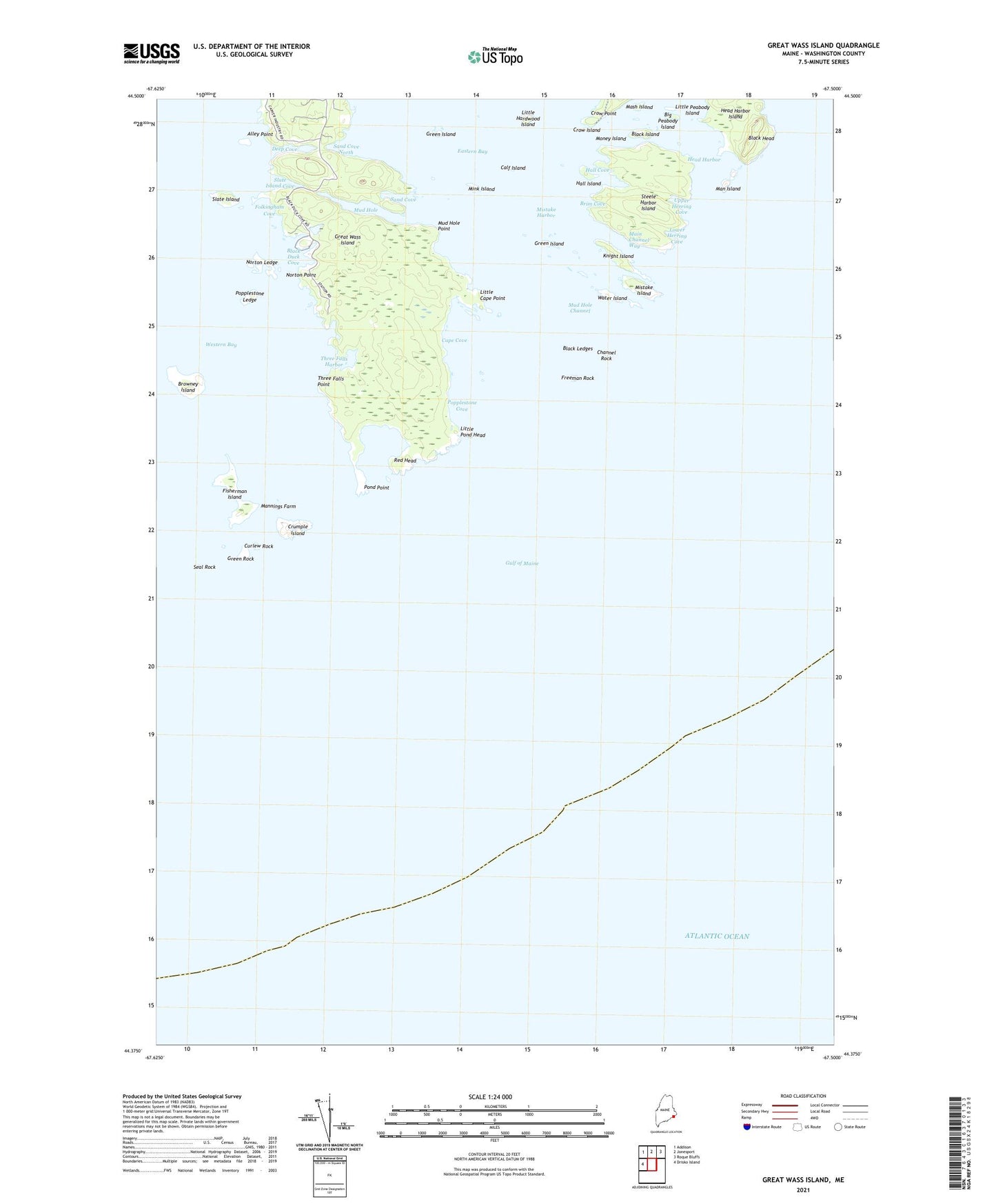
2024 topographic map quadrangle Great Wass Island in the state of Maine. Scale: 1:24000. Based on the newly updated USGS 7.5' US Topo map series, this map is in the following counties: Washington. The map contains contour data, water features, and other items you are used to seeing on USGS maps, but also has updated roads and other features. This is the next generation of topographic maps. Printed on high-quality waterproof paper with UV fade-resistant inks.
Quads adjacent to this one:
West: Drisko Island
Northwest: Addison
North: Jonesport
Northeast: Roque Bluffs
This map covers the same area as the classic USGS quad with code o44067d5.
Contains the following named places: Alley Point, Big Peabody Island, Black Duck Cove, Black Head, Black Island, Black Ledges, Brim Cove, Browney Island, Calf Island, Cape Cove, Channel Rock, Crow Island, Crow Point, Crumple Island, Curlew Rock, Deep Cove, Eastern Bay, Fisherman Island, Folkingham Cove, Freeman Rock, Great Wass Island, Great Wass Island Preserve, Green Island, Green Rock, Hall Cove, Hall Island, Head Harbor, Knight Island, Little Cape Point, Little Hardwood Island, Little Peabody Island, Little Pond Head, Lower Herring Cove, Main Channel Way, Man Island, Mannings Farm, Mash Island, Mink Island, Mistake Harbor, Mistake Island, Money Island, Moose Peak Light, Mud Hole, Mud Hole Channel, Mud Hole Point, Mud Hole Trail, Norton Ledge, Norton Point, Pond Point, Popplestone Cove, Popplestone Ledge, Red Head, Sand Cove, Sand Cove North, Seal Rock, Slate Island, Slate Island Cove, Steele Harbor Island, The Cows Yard, The Pond, Three Falls Harbor, Three Falls Point, Town of Beals, Upper Herring Cove, Water Island, ZIP Code: 04611