MyTopo
Addison Maine US Topo Map
Couldn't load pickup availability
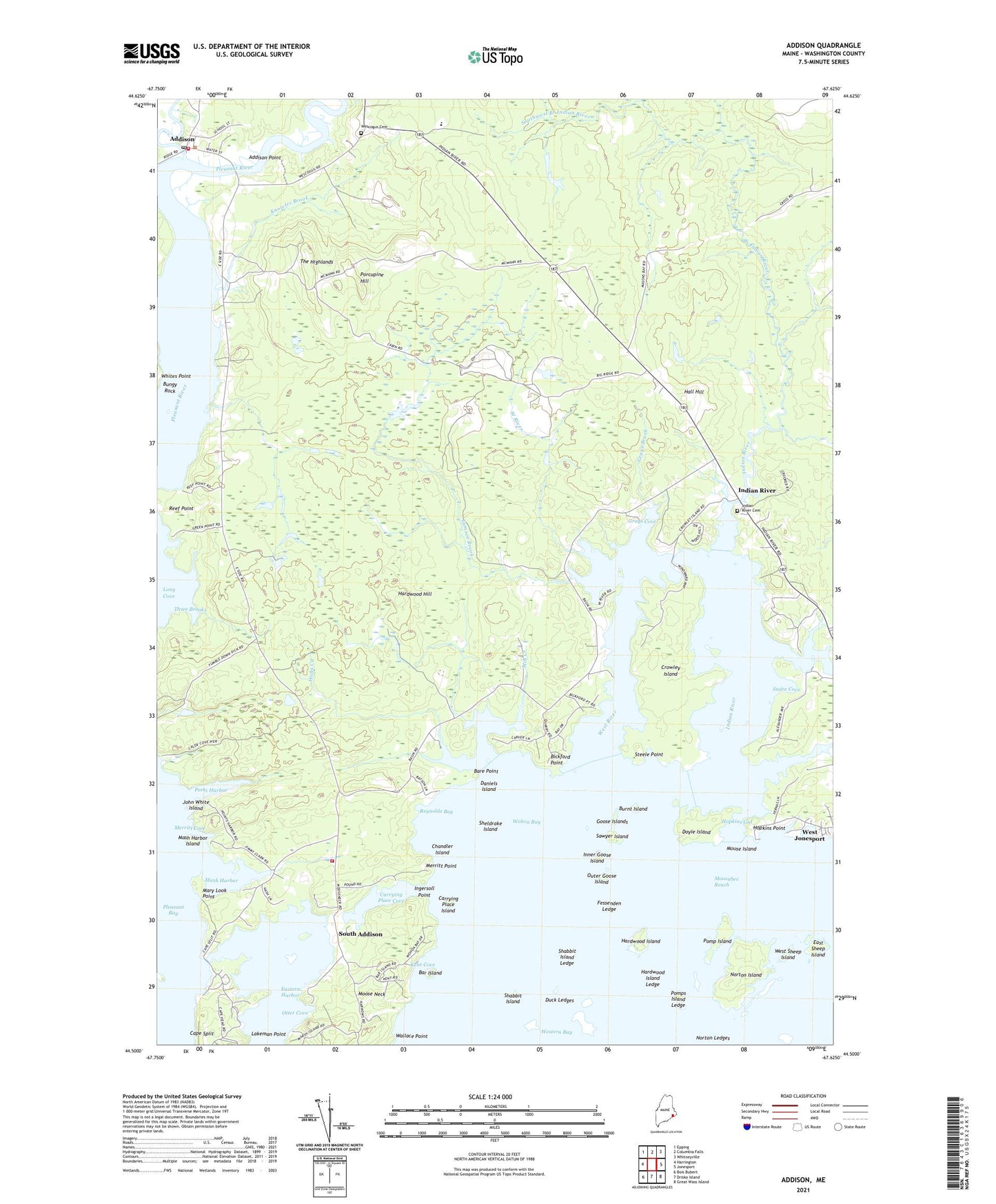
2024 topographic map quadrangle Addison in the state of Maine. Scale: 1:24000. Based on the newly updated USGS 7.5' US Topo map series, this map is in the following counties: Washington. The map contains contour data, water features, and other items you are used to seeing on USGS maps, but also has updated roads and other features. This is the next generation of topographic maps. Printed on high-quality waterproof paper with UV fade-resistant inks.
Quads adjacent to this one:
West: Harrington
Northwest: Epping
North: Columbia Falls
Northeast: Whitneyville
East: Jonesport
Southeast: Great Wass Island
South: Drisko Island
Southwest: Bois Bubert
This map covers the same area as the classic USGS quad with code o44067e6.
Contains the following named places: Addison, Addison Point, Addison Post Office, Addison Volunteer Fire Department South Addison, Addison Volunteer Fire Department Village Station, Bar Island, Bare Point, Bickford Point, Bryant Corners, Bungy Rock, Burnt Island, Cape Split, Carrying Place Cove, Carrying Place Island, Chandler Island, Crowley Island, D W Merritt Elementary School, Daniels Island, Doyle Island, Duck Ledges, East Sheep Island, Eastern Harbor, Fessenden Ledge, Goose Islands, Grays Brook, Grays Cove, Halftide Ledge, Hall Hill, Hardwood Hill, Hardwood Island, Hardwood Island Ledge, Hay Creek, Hicks Creek, Hopkins Gut, Hopkins Point, Indian River, Indian River Baptist Church, Indian River Cemetery, Ingersoll Point, Inner Goose Island, John White Island, Kent Cove, Knowles Brook, Lakeman Point, Lamsen Brook, Long Cove, Long Creek, Mary Look Point, Mash Harbor, Mash Harbor Island, Mayhew Library Association, Merritt Cove, Merritt Point, Mill Creek, Moose Neck, Mouse Island, Norton Island, Norton Ledges, Otter Cove, Outer Goose Island, Pomp Island, Pomps Island Ledge, Porcupine Hill, Ports Harbor, Reynolds Bay, Sawyer Island, Shabbit Island, Shabbit Island Ledge, Sheldrake Island, Snare Cove, Snare Creek, South Addison, Southwest Branch Indian River, Steele Point, The Basin School, The Highlands, Three Brooks, Town of Addison, Tracy Corners, Upper East Side School, Wallace Point, Wescogus Cemetery, West Branch Pleasant River, West Branch Pleasant River Dam, West Branch Pleasant River Reservoir, West River, West Sheep Island, Whites Point, Wohoa Bay, ZIP Code: 04606