MyTopo
Drisko Island Maine US Topo Map
Couldn't load pickup availability
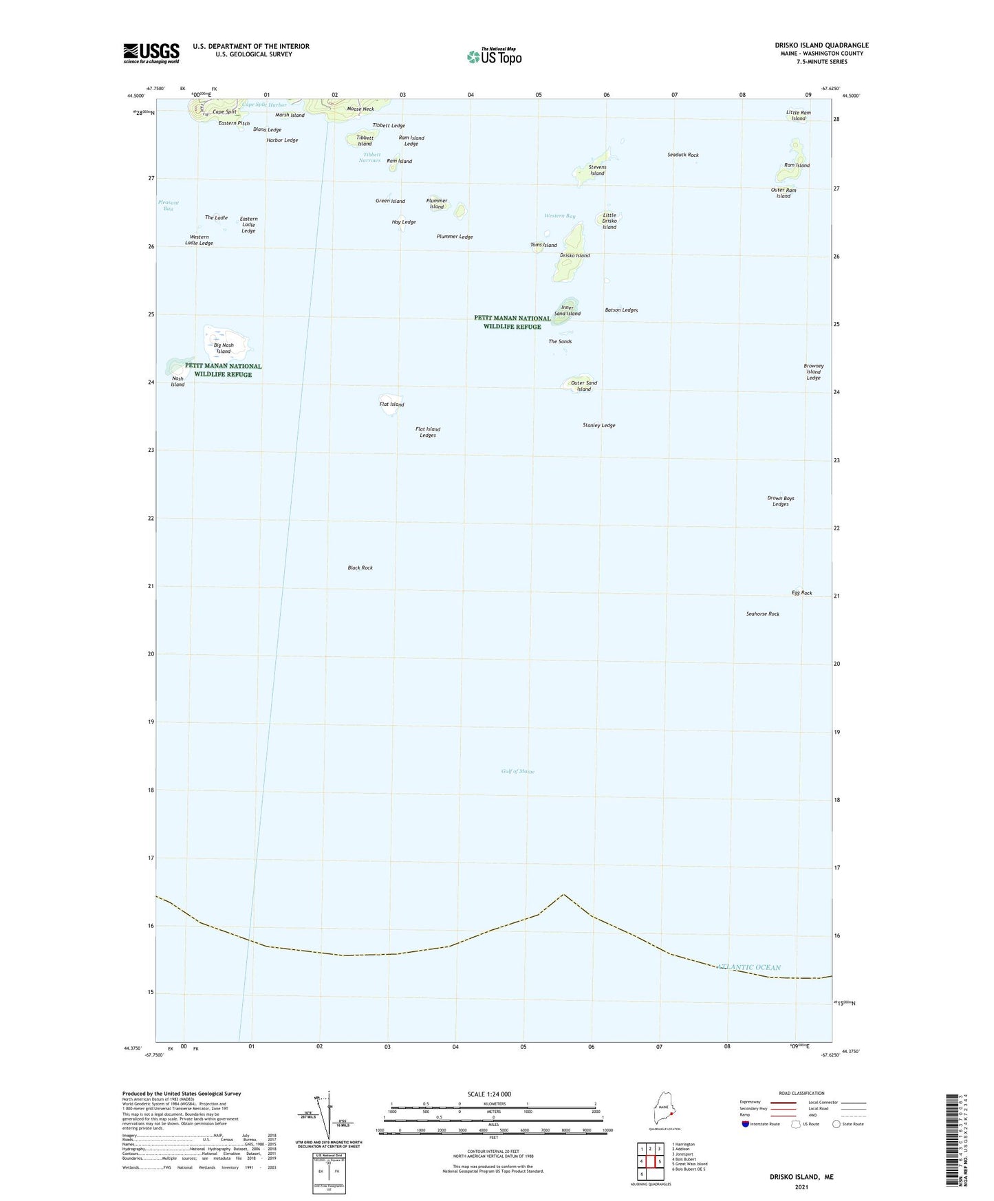
2024 topographic map quadrangle Drisko Island in the state of Maine. Scale: 1:24000. Based on the newly updated USGS 7.5' US Topo map series, this map is in the following counties: Washington. The map contains contour data, water features, and other items you are used to seeing on USGS maps, but also has updated roads and other features. This is the next generation of topographic maps. Printed on high-quality waterproof paper with UV fade-resistant inks.
Quads adjacent to this one:
West: Bois Bubert
Northwest: Harrington
North: Addison
Northeast: Jonesport
East: Great Wass Island
Southwest: Bois Bubert OE S
This map covers the same area as the classic USGS quad with code o44067d6.
Contains the following named places: Batson Ledges, Big Nash Island, Black Rock, Browney Island Ledge, Cape Split Harbor, Diana Ledge, Drisko Island, Drown Boys Ledges, Eastern Ladle Ledge, Eastern Pitch, Egg Rock, Flat Island, Flat Island Ledges, Green Island, Harbor Ledge, Hay Ledge, Inner Sand Island, Little Drisko Island, Little Ram Island, Marsh Island, Nash Island, Nash Island Light, Outer Ram Island, Outer Sand Island, Plummer Island, Plummer Ledge, Ram Island, Ram Island Ledge, Seaduck Rock, Seahorse Rock, Stanley Ledge, Stevens Island, The Ladle, The Sands, Tibbett Island, Tibbett Ledge, Tibbett Narrows, Toms Island, Western Bay, Western Ladle Ledge