MyTopo
Jack Mountain Maine US Topo Map
Couldn't load pickup availability
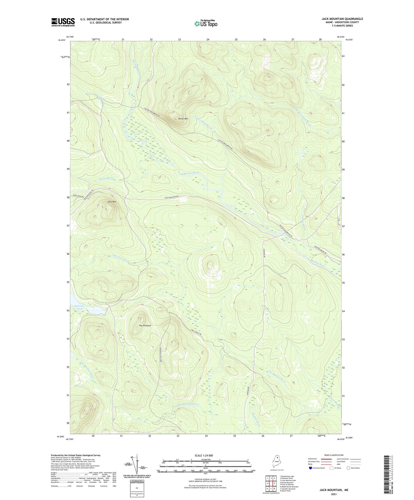
2021 topographic map quadrangle Jack Mountain in the state of Maine. Scale: 1:24000. Based on the newly updated USGS 7.5' US Topo map series, this map is in the following counties: Aroostook. The map contains contour data, water features, and other items you are used to seeing on USGS maps, but also has updated roads and other features. This is the next generation of topographic maps. Printed on high-quality waterproof paper with UV fade-resistant inks.
Quads adjacent to this one:
West: Round Mountain
Northwest: Big Machias Lake
North: Greenlaw Pond
Northeast: Little Machias Lake
East: Forks of Machias
Southeast: Oxbow West
South: Chandler Mountain
Southwest: Middle Brook Mountain
Contains the following named places: Dead Brook, Donkey Deadwater, Foster-Rand Brook, Horse Mountain, Jack Mountain, McKeen Crossing, North Branch Camp, Rand Landing, Round Trail, Rowe Brook, Spectacle Brook, Spectacle Pond, T10 R7 WELS, T11 R7 WELS, The Owls Roost, The Pinnacle, Trafton Pond, Weeks Brook