MyTopo
Oxbow West Maine US Topo Map
Couldn't load pickup availability
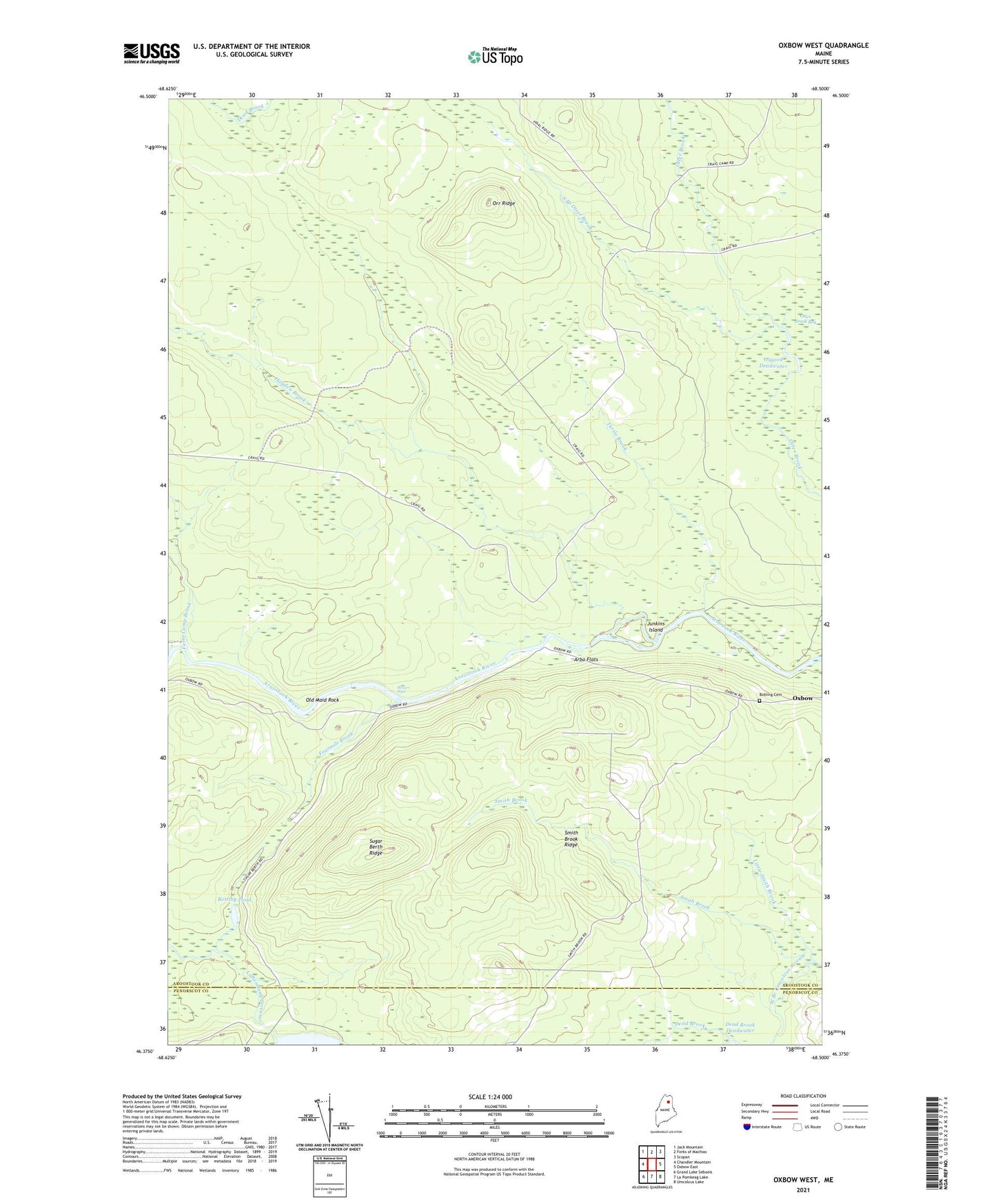
2024 topographic map quadrangle Oxbow West in the state of Maine. Scale: 1:24000. Based on the newly updated USGS 7.5' US Topo map series, this map is in the following counties: Aroostook, Penobscot. The map contains contour data, water features, and other items you are used to seeing on USGS maps, but also has updated roads and other features. This is the next generation of topographic maps. Printed on high-quality waterproof paper with UV fade-resistant inks.
Quads adjacent to this one:
West: Chandler Mountain
Northwest: Jack Mountain
North: Forks of Machias
Northeast: Scopan
East: Oxbow East
Southeast: Umcolcus Lake
South: La Pomkeag Lake
Southwest: Grand Lake Seboeis
This map covers the same area as the classic USGS quad with code o46068d5.
Contains the following named places: Arbo Flats, Bastc Rips, Botting Cemetery, Botting Pond, Dead Brook, Farm Camp Brook, Fourmile Brook, Hayden Brook, Junkins Camp, Junkins Island, Little Smith Brook, Old Maid Rock, Orr Ridge, Osgood Deadwater, Oxbow Checkpoint Building, Plantation of Oxbow, Smith Brook, Smith Brook Deadwater, Smith Brook Ridge, South Branch Otter Brook, Sugar Berth Ridge, Turtle Brook, ZIP Code: 04764