MyTopo
Jackman Maine US Topo Map
Couldn't load pickup availability
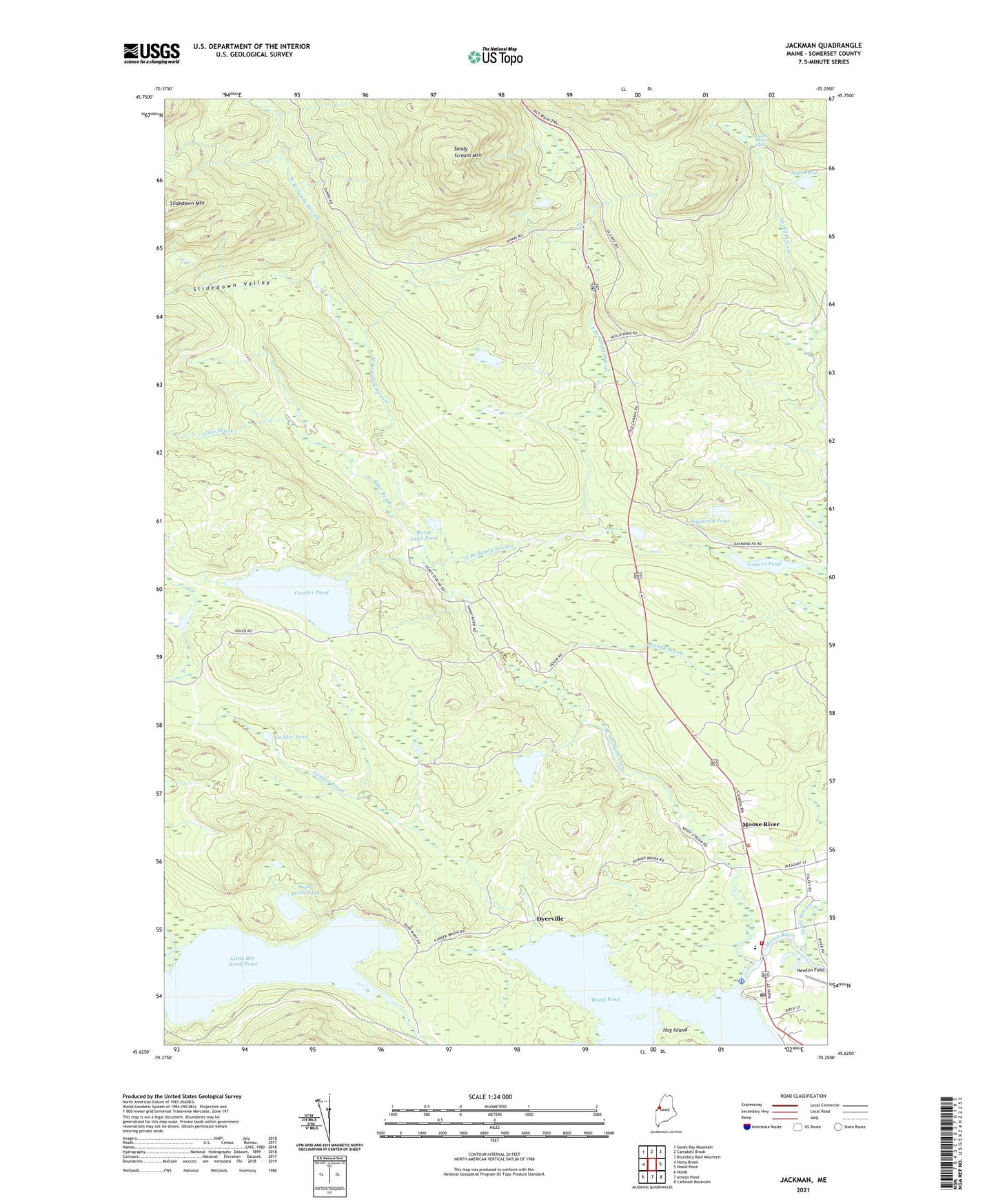
2024 topographic map quadrangle Jackman in the state of Maine. Scale: 1:24000. Based on the newly updated USGS 7.5' US Topo map series, this map is in the following counties: Somerset. The map contains contour data, water features, and other items you are used to seeing on USGS maps, but also has updated roads and other features. This is the next generation of topographic maps. Printed on high-quality waterproof paper with UV fade-resistant inks.
Quads adjacent to this one:
West: Stony Brook
Northwest: Sandy Bay Mountain
North: Campbell Brook
Northeast: Boundary Bald Mountain
East: Heald Pond
Southeast: Catheart Mountain
South: Attean Pond
Southwest: Holeb
This map covers the same area as the classic USGS quad with code o45070f3.
Contains the following named places: Alder Brook, Brandy Brook, Burnt Land Pond, Coburn Pond, Crocker Pond, Crocker Pond Dam, Daymond Pond, Dennistown, Dyerville, East Branch Sandy Stream, Forest Hills Consolidated School, Foxs Camp, Gander Brook, Gander Pond, Heald Stream, Heald Stream Falls, Hog Island, Holden Cemetery, Jackman Moose River Fire Department, Jackman Post Office, Jackman Public Library, Little Big Wood Pond, Moose River, Moose River Seaplane Base, Mud Pond, Newton Field, Plantation of Dennistown, Rancourt Pond, Sandy Stream Mountain, Sky Lodge Landing Strip, Slidedown Valley, Stetson School, Sugar Berth Pond, The Falls, West Branch Sandy Stream