MyTopo
Stony Brook Maine US Topo Map
Couldn't load pickup availability
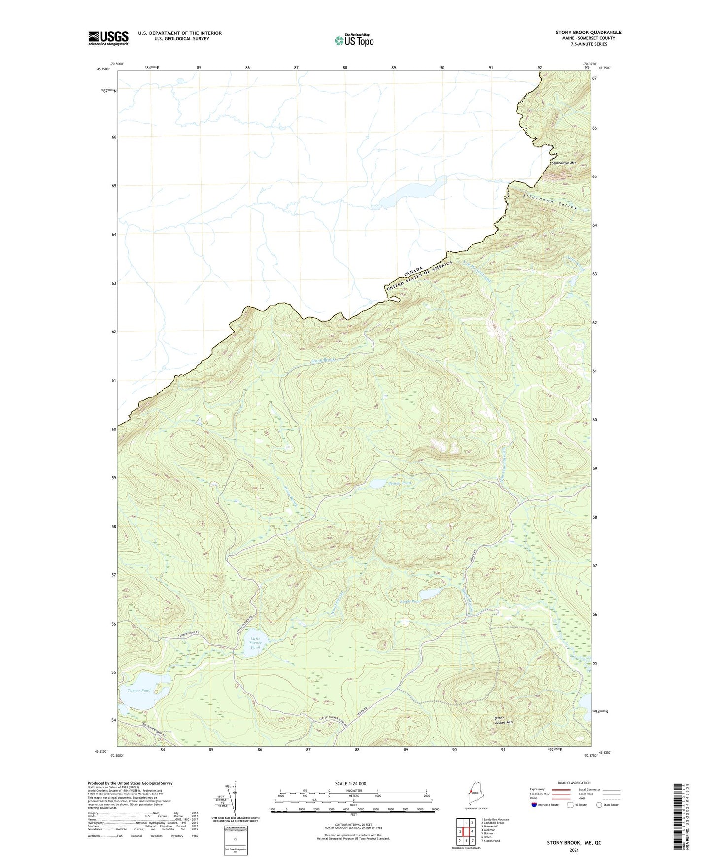
2024 topographic map quadrangle Stony Brook in the state of Maine. Scale: 1:24000. Based on the newly updated USGS 7.5' US Topo map series, this map is in the following counties: Somerset. The map contains contour data, water features, and other items you are used to seeing on USGS maps, but also has updated roads and other features. This is the next generation of topographic maps. Printed on high-quality waterproof paper with UV fade-resistant inks.
Quads adjacent to this one:
West: Skinner NE
North: Sandy Bay Mountain
Northeast: Campbell Brook
East: Jackman
Southeast: Attean Pond
South: Holeb
Southwest: Skinner
This map covers the same area as the classic USGS quad with code o45070f4.
Contains the following named places: Beaver Pond, Burnt Jacket Mountain, Forsyth Township, Little Turner Pond, North Branch Wood Stream, Slidedown Mountain, Smith Pond, Stony Brook, Turner Pond