MyTopo
Attean Pond Maine US Topo Map
Couldn't load pickup availability
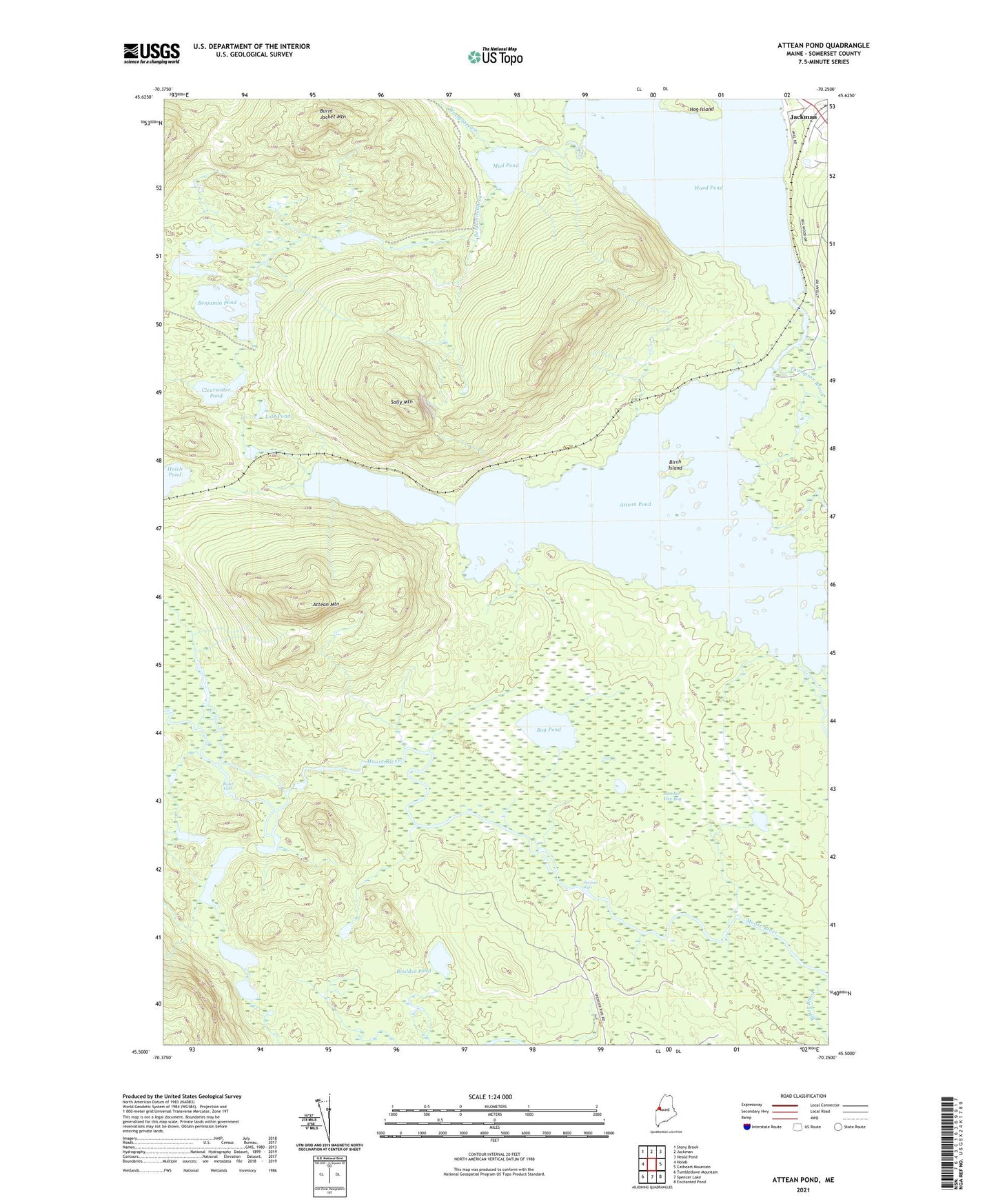
2024 topographic map quadrangle Attean Pond in the state of Maine. Scale: 1:24000. Based on the newly updated USGS 7.5' US Topo map series, this map is in the following counties: Somerset. The map contains contour data, water features, and other items you are used to seeing on USGS maps, but also has updated roads and other features. This is the next generation of topographic maps. Printed on high-quality waterproof paper with UV fade-resistant inks.
Quads adjacent to this one:
West: Holeb
Northwest: Stony Brook
North: Jackman
Northeast: Heald Pond
East: Catheart Mountain
Southeast: Enchanted Pond
South: Spencer Lake
Southwest: Tumbledown Mountain
This map covers the same area as the classic USGS quad with code o45070e3.
Contains the following named places: Attean, Attean Landing, Attean Mountain, Attean Pond, Attean Township, Benjamin Brook, Benjamin Pond, Birch Island, Bitter Brook, Bog Pond, Boulder Pond, Clearwater Pond, Holeb Falls, Horseshoe Pond, Jackman, Long Pond, Lost Pond, McKenney Brook, Mud Pond, Number Five Bog, Number Five Farm, Sally Mountain, Spencer Rips, T5 R7 BKP WKR, Thompson Brook, Tobey Ponds, Williams Brook, Wood Pond, Wood Stream