MyTopo
Jackson Mountain Maine US Topo Map
Couldn't load pickup availability
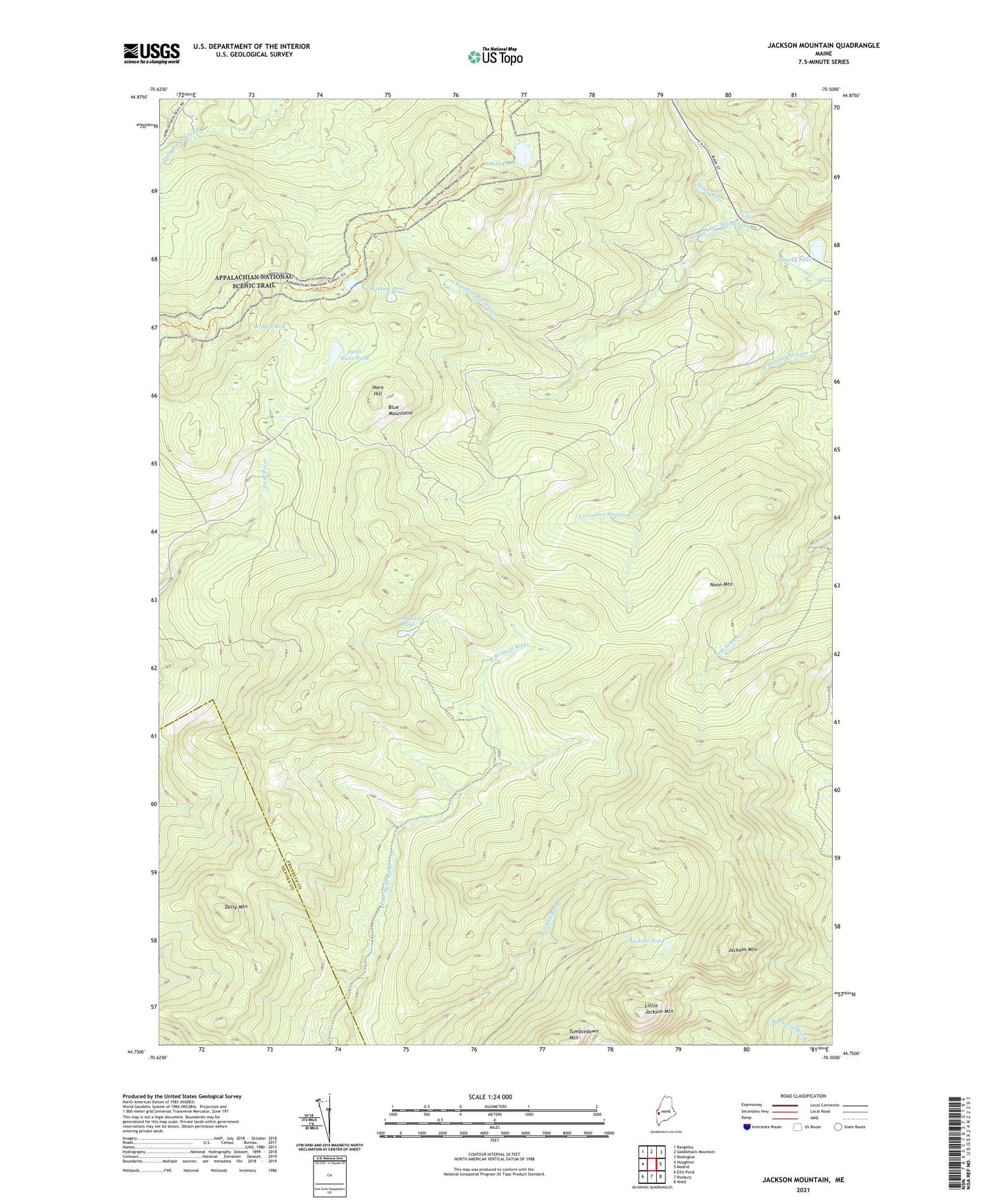
2021 topographic map quadrangle Jackson Mountain in the state of Maine. Scale: 1:24000. Based on the newly updated USGS 7.5' US Topo map series, this map is in the following counties: Franklin, Oxford. The map contains contour data, water features, and other items you are used to seeing on USGS maps, but also has updated roads and other features. This is the next generation of topographic maps. Printed on high-quality waterproof paper with UV fade-resistant inks.
Quads adjacent to this one:
West: Houghton
Northwest: Rangeley
North: Saddleback Mountain
Northeast: Redington
East: Madrid
Southeast: Weld
South: Roxbury
Southwest: Ellis Pond
Contains the following named places: Blue Mountains, Chandler Mill Stream, Dolly Mountain, Harvey Pond, Horn Hill, Jackson Mountain, Jackson Pond, Little Jackson Mountain, Little Swift River Pond, Noon Mountain, Smalls Falls, South Pond, Southwest Pond, Swift River Pond, Township 6 North of Weld, Township E, Tumbledown Mountain, Unorganized Territory of West Central Franklin, Witham Bog, Witham Pond