MyTopo
Ellis Pond Maine US Topo Map
Couldn't load pickup availability
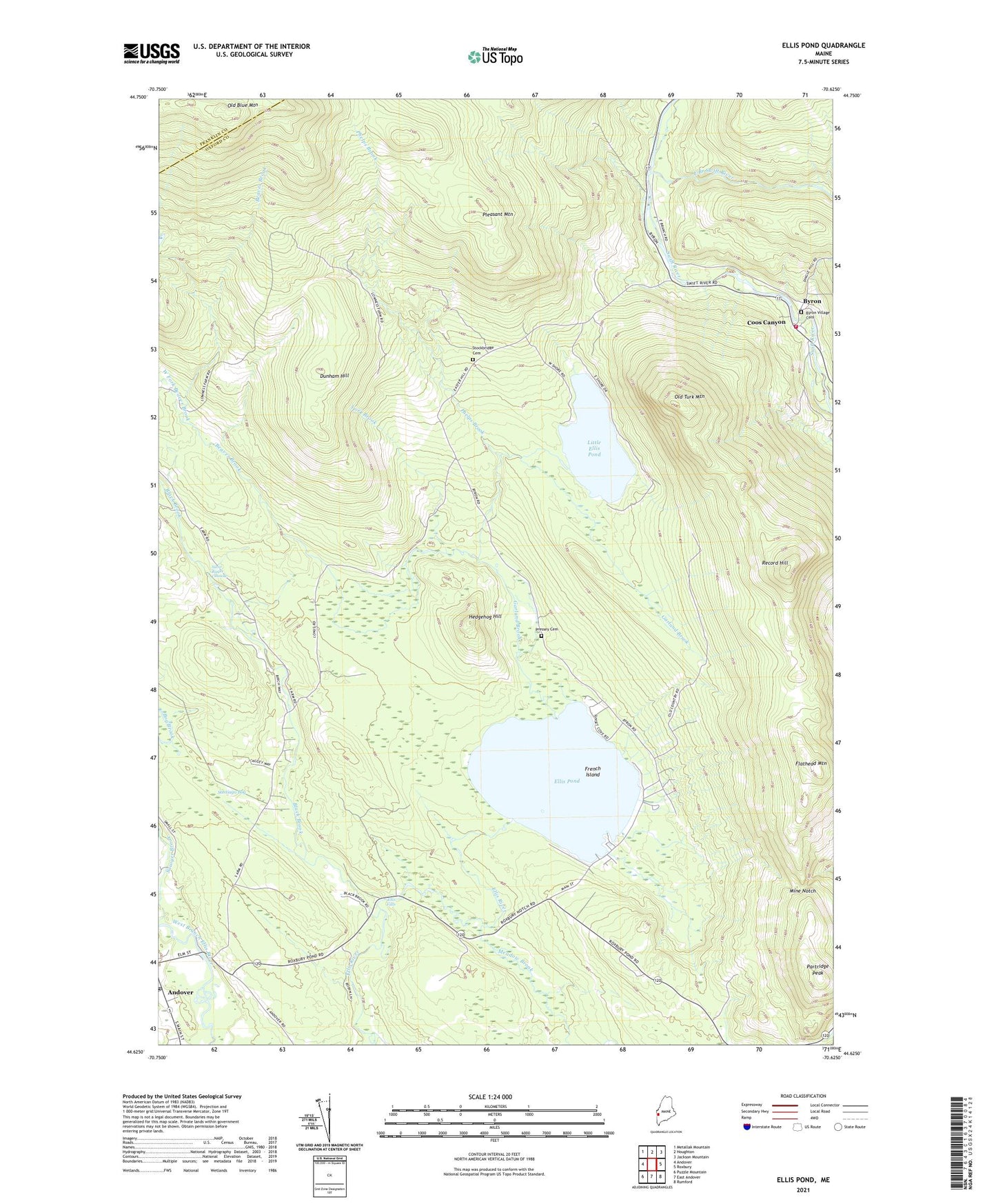
2024 topographic map quadrangle Ellis Pond in the state of Maine. Scale: 1:24000. Based on the newly updated USGS 7.5' US Topo map series, this map is in the following counties: Oxford, Franklin. The map contains contour data, water features, and other items you are used to seeing on USGS maps, but also has updated roads and other features. This is the next generation of topographic maps. Printed on high-quality waterproof paper with UV fade-resistant inks.
Quads adjacent to this one:
West: Andover
Northwest: Metallak Mountain
North: Houghton
Northeast: Jackson Mountain
East: Roxbury
Southeast: Rumford
South: East Andover
Southwest: Puzzle Mountain
This map covers the same area as the classic USGS quad with code o44070f6.
Contains the following named places: Andover Post Office, Beaver Brook, Black Brook, Bog Brook, Byron, Byron Village Cemetery, Byron Volunteer Fire Station, Coos Canyon, Dunham Hill, East Branch Swift River, Ellis Falls, Ellis Pond, First Congregational Church, Flathead Mountain, French Island, Garland Brook, Hedgehog Hill, Horseshoe Brook, Little Ellis Pond, Meadow Brook, Mine Notch, Old Turk Mountain, Partridge Peak, Phelps Brook, Pleasant Mountain, Pressey Cemetery, Record Hill, Roxbury Notch, Santiago Bog, Sawyer Brook, Silver Ripple Cascade, Stockbridge Cemetery, Town of Byron, West Fork Beaver Brook, York Brook, ZIP Code: 04275