MyTopo
Houghton Maine US Topo Map
Couldn't load pickup availability
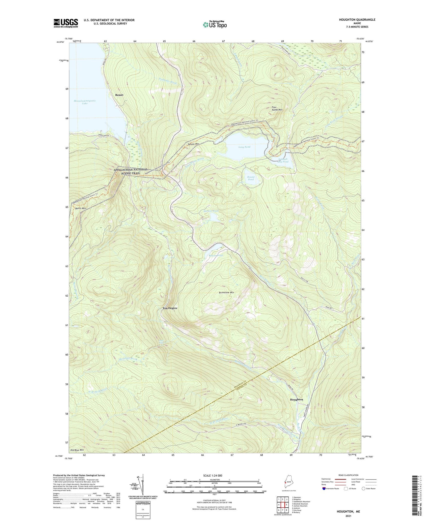
2024 topographic map quadrangle Houghton in the state of Maine. Scale: 1:24000. Based on the newly updated USGS 7.5' US Topo map series, this map is in the following counties: Franklin, Oxford. The map contains contour data, water features, and other items you are used to seeing on USGS maps, but also has updated roads and other features. This is the next generation of topographic maps. Printed on high-quality waterproof paper with UV fade-resistant inks.
Quads adjacent to this one:
West: Metallak Mountain
Northwest: Oquossoc
North: Rangeley
Northeast: Saddleback Mountain
East: Jackson Mountain
Southeast: Roxbury
South: Ellis Pond
Southwest: Andover
This map covers the same area as the classic USGS quad with code o44070g6.
Contains the following named places: Angel Falls, Angel Falls Trail, Beaver Pond, Bemis, Bemis Stream, Bemis Stream Trail, Bemis Trail, Berdeen Stream, Brimstone Mountain, Four Ponds Brook, Four Ponds Mountain, Height of Land Scenic Overlook, Houghton, Long Pond, Maxie Pond, Mott Stream, Mountain Brook, Round Pond, Sabbath Day Pond, Spencer Pond, Spruce Mountain, Summit, Ten Degree, Toothaker Brook, Township D, Welch Brook, West Branch Swift River