MyTopo
Johnson Mountain Maine US Topo Map
Couldn't load pickup availability
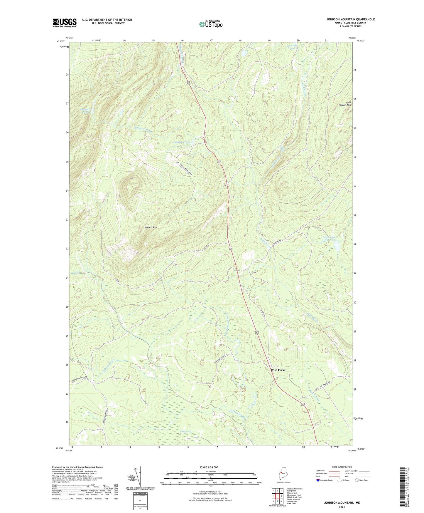
2021 topographic map quadrangle Johnson Mountain in the state of Maine. Scale: 1:24000. Based on the newly updated USGS 7.5' US Topo map series, this map is in the following counties: Somerset. The map contains contour data, water features, and other items you are used to seeing on USGS maps, but also has updated roads and other features. This is the next generation of topographic maps. Printed on high-quality waterproof paper with UV fade-resistant inks.
Quads adjacent to this one:
West: Enchanted Pond
Northwest: Catheart Mountain
North: Long Pond
Northeast: Misery Knob
East: Black Brook Pond
Southeast: The Forks
South: Pierce Pond
Southwest: Basin Mountain
Contains the following named places: Cold Stream Falls, Cold Stream Mountain, East Branch Salmon Stream, Johnson Mountain, Johnson Mountain Township, Little Wilson Hill Pond, Markham Pond, Mountain Brook, Mountain Ponds, Plantation of West Forks, Salmon Stream Farm, West Forks