MyTopo
Lake Cathance Maine US Topo Map
Couldn't load pickup availability
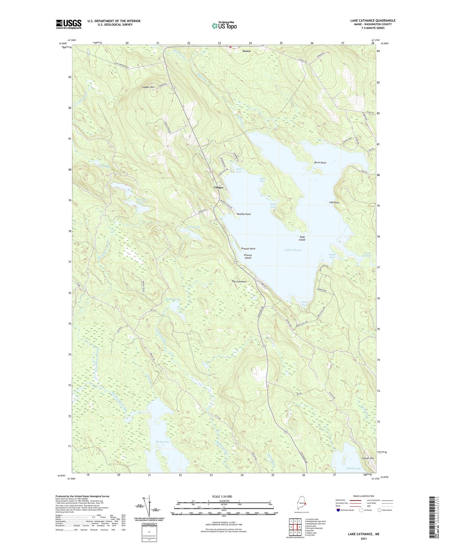
2021 topographic map quadrangle Lake Cathance in the state of Maine. Scale: 1:24000. Based on the newly updated USGS 7.5' US Topo map series, this map is in the following counties: Washington. The map contains contour data, water features, and other items you are used to seeing on USGS maps, but also has updated roads and other features. This is the next generation of topographic maps. Printed on high-quality waterproof paper with UV fade-resistant inks.
Quads adjacent to this one:
West: Round Lake
Northwest: Crawford Lake
North: Meddybemps Lake West
Northeast: Meddybemps Lake East
East: Porcupine Mountain
Southeast: Long Lake
South: Hadley Lake
Southwest: Bog Lake
Contains the following named places: Big Inlet, Birch Point, Cathance Lake Dam, Chub Cove, Conner Hill, Cooper, Cooper Hill, Cooper Volunteer Fire Department, Dead Brook, Deep Cove, East Ridge School, Fox Point, Gray Cove, Howe Brook, Lake Cathance, Little Inlet, Mill Stream, Mud Lake, Munson Lake, Murphy Point, Northern Stream, Patrick Lake, Provost Island, Provost Point, Richardson Brook, Sand Cove, Smith Cove, Spectacle Lakes, The Commons, Todd Island, Town of Cooper, Vining Lake, West Ridge School, ZIP Code: 04657