MyTopo
Hadley Lake Maine US Topo Map
Couldn't load pickup availability
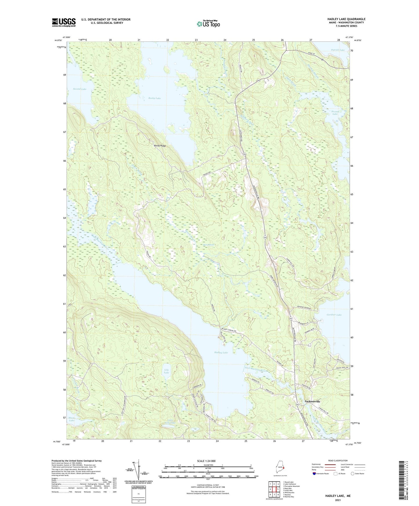
2024 topographic map quadrangle Hadley Lake in the state of Maine. Scale: 1:24000. Based on the newly updated USGS 7.5' US Topo map series, this map is in the following counties: Washington. The map contains contour data, water features, and other items you are used to seeing on USGS maps, but also has updated roads and other features. This is the next generation of topographic maps. Printed on high-quality waterproof paper with UV fade-resistant inks.
Quads adjacent to this one:
West: Bog Lake
Northwest: Round Lake
North: Lake Cathance
Northeast: Porcupine Mountain
East: Long Lake
Southeast: Machias Bay
South: Machias
Southwest: Whitneyville
This map covers the same area as the classic USGS quad with code o44067g4.
Contains the following named places: Berry Heath, Berry Township, Chase Mills Stream, Crocker Brook, Gooch Brook, Hadley Lake, Hadley Lake School, Jacksonville, Lily Lake, Little Lily Lake, Mud Landing, Northern Inlet, Patrick Brook, Rocky Lake, Rocky Ridge, Second Lake, Southern Inlet, Spirit Brook, Town of East Machias, Town of Marshfield, ZIP Code: 04630