MyTopo
Limerick Maine US Topo Map
Couldn't load pickup availability
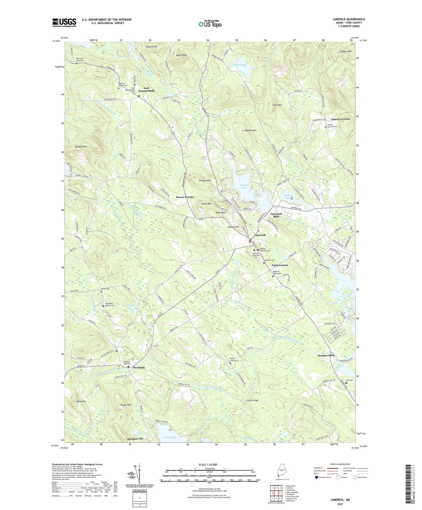
2024 topographic map quadrangle Limerick in the state of Maine. Scale: 1:24000. Based on the newly updated USGS 7.5' US Topo map series, this map is in the following counties: York. The map contains contour data, water features, and other items you are used to seeing on USGS maps, but also has updated roads and other features. This is the next generation of topographic maps. Printed on high-quality waterproof paper with UV fade-resistant inks.
Quads adjacent to this one:
West: West Newfield
Northwest: Kezar Falls
North: Cornish
Northeast: Steep Falls
East: Limington
Southeast: Waterboro
South: Mousam Lake
Southwest: Great East Lake
This map covers the same area as the classic USGS quad with code o43070f7.
Contains the following named places: Bald Head, Baptist Society Cemetery, Benson Brook, Branch Brook, Buff Brook, Cannon Hill, Chellis Brook, Clark Mountain, Clarks Bridge, Day Cemetery, Dearborn - Foss Cemetery, East Parsonsfield, Emerys Corner, Emerys Corner Cemetery, Felch Corner, Fenderson Brook, Guptill Hill, Haley Pond, Harvey Mill Stream, Highland Cemetery, Highland Cemetery Annex, Hoyt Mountain, Knox Mountain, Leavitt Brook, Limerick, Limerick Mills, Limerick Post Office, Limerick Public Library, Limerick Volunteer Fire Department, Line Elementary School, Moulton Brook, Nason Gray Lot, Newfield, Newfield Historic District, Newfield Post Office, Newfield Village Library Reading Room, Noahs Pond, Ossipee Mills, Ossipee Valley Christian School, Pendexter Brook, Perry Pond, Perrys Corner, Philpot Mountain, Pickerel Pond, Picket Mountain, Pleasant Hill Cemetery, Randall Mountain, Sanborn Eastman Lot, Sawyer Mountain, Silver Lake, Sokokis Lake, Sokokis Lake Dam, Spencer Brook, Sprague City, Stone Cemetery, Symmes Pond Dam, Thompson Family Cemetery, Towle Mountain, Town of Limerick, Watson Mountain, Willowbrook Museum, ZIP Code: 04048