MyTopo
Mahoney Hill Maine US Topo Map
Couldn't load pickup availability
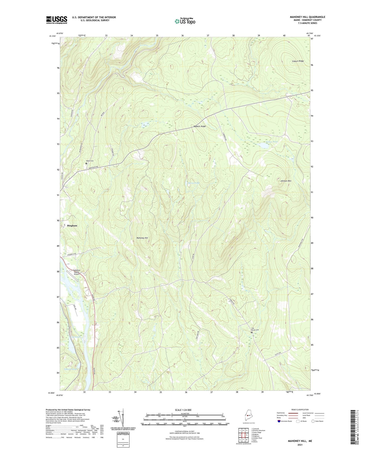
2021 topographic map quadrangle Mahoney Hill in the state of Maine. Scale: 1:24000. Based on the newly updated USGS 7.5' US Topo map series, this map is in the following counties: Somerset. The map contains contour data, water features, and other items you are used to seeing on USGS maps, but also has updated roads and other features. This is the next generation of topographic maps. Printed on high-quality waterproof paper with UV fade-resistant inks.
Quads adjacent to this one:
West: Bingham
Northwest: Caratunk
North: Dimmick Mountain
Northeast: Foster Ridge
East: Kingsbury
Southeast: Athens
South: Solon
Southwest: Embden Pond
Contains the following named places: Babbitt Ridge, Baker Cemetery, Bassett Brook, Bingham Census Designated Place, Chase Stream, Coburn Ridge, Fall Brook Cemetery, Gadabout Gaddis Airport, Gulf Stream, Jackson Brook, Johnson Brook, Johnson Corner, Johnson Mountain, Lily Pond, Mahoney Hill, Morse Pond, Tibbetts Pond, Town of Bingham, Town of Moscow, Upper Kennebec Valley Junior Senior High School, Withee Pond