MyTopo
Kingsbury Maine US Topo Map
Couldn't load pickup availability
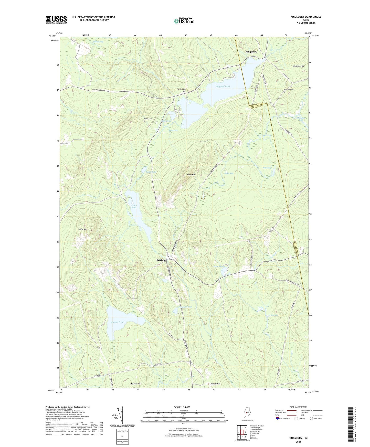
2024 topographic map quadrangle Kingsbury in the state of Maine. Scale: 1:24000. Based on the newly updated USGS 7.5' US Topo map series, this map is in the following counties: Somerset, Piscataquis. The map contains contour data, water features, and other items you are used to seeing on USGS maps, but also has updated roads and other features. This is the next generation of topographic maps. Printed on high-quality waterproof paper with UV fade-resistant inks.
Quads adjacent to this one:
West: Mahoney Hill
Northwest: Dimmick Mountain
North: Foster Ridge
Northeast: Whetstone Pond
East: Wellington
Southeast: Harmony
South: Athens
Southwest: Solon
This map covers the same area as the classic USGS quad with code o45069a6.
Contains the following named places: Bigelow Brook, Brighton, Bryant Bog, Bunker Hill, Decker Bog, Flanders Cemetery, Foss Hill Cemetery, Foss Mountain, Kelley Cemetery, Kelly Mountain, Kingsbury, Kingsbury Dam, Kingsbury Pond, Mayfield Corner, Mayfield Pond, Moody Corner, Otter Pond, Palin Pond, Plantation of Brighton, Potter Bog, Prentiss Pond, Scribner Bog, Smith Pond, Trout Pond, Wellington Bog, Wyman Pond