MyTopo
Solon Maine US Topo Map
Couldn't load pickup availability
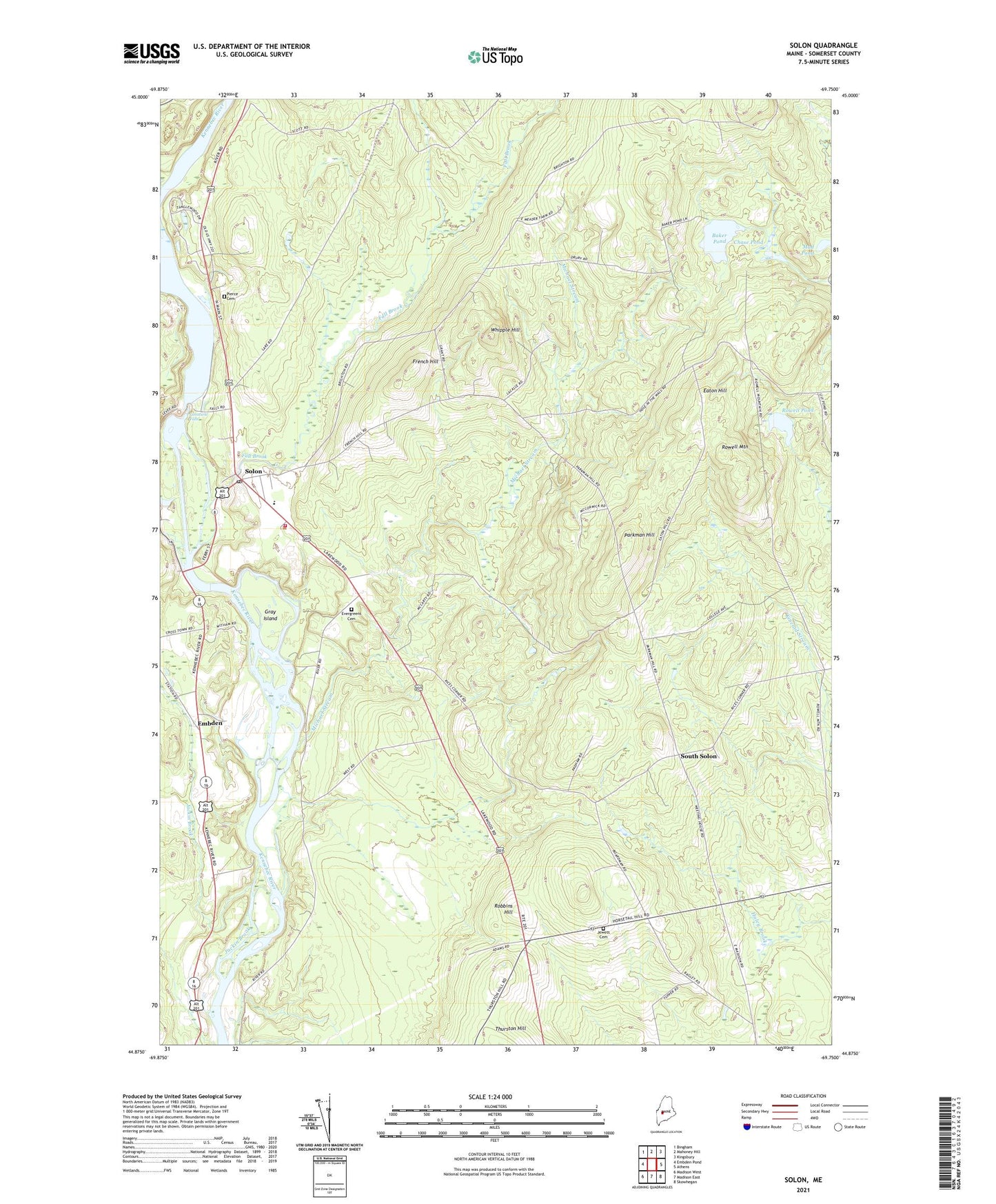
2024 topographic map quadrangle Solon in the state of Maine. Scale: 1:24000. Based on the newly updated USGS 7.5' US Topo map series, this map is in the following counties: Somerset. The map contains contour data, water features, and other items you are used to seeing on USGS maps, but also has updated roads and other features. This is the next generation of topographic maps. Printed on high-quality waterproof paper with UV fade-resistant inks.
Quads adjacent to this one:
West: Embden Pond
Northwest: Bingham
North: Mahoney Hill
Northeast: Kingsbury
East: Athens
Southeast: Skowhegan
South: Madison East
Southwest: Madison West
This map covers the same area as the classic USGS quad with code o44069h7.
Contains the following named places: Alder Brook, Arnolds Landing, Baker Pond, Caratunk Falls, Chase Pond, Coolidge Library, Eaton Hill, Embden, Evergreens Cemetery, Fall Brook, French Hill, Gray Island, Jackin Brook, Jewett Cemetery, Kennebec River Reservoir, Michael Stream, Mill Stream, Mud Pond, Parkman Hill, Pierce Cemetery, Purington School, Rice Corner, Robbins Hill, Rowell Mountain, Rowell Pond, Solon, Solon Congregational Church, Solon Elementary School, Solon Post Office, Solon Volunteer Fire Department, South Solon, Town of Solon, Twelve Corners, Whipple Hill, Williams Dam, ZIP Code: 04979