MyTopo
Mars Hill Maine US Topo Map
Couldn't load pickup availability
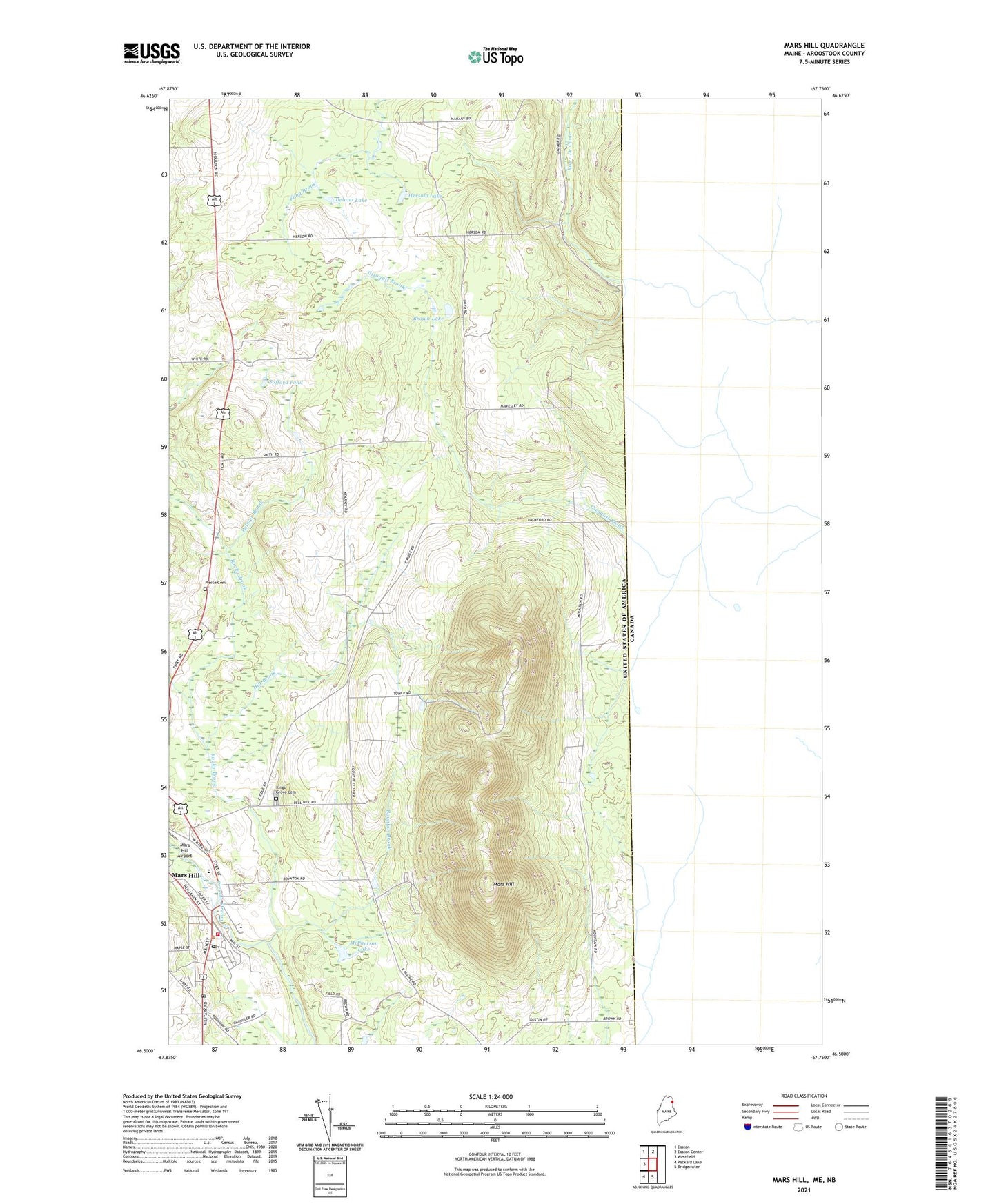
2024 topographic map quadrangle Mars Hill in the state of Maine. Scale: 1:24000. Based on the newly updated USGS 7.5' US Topo map series, this map is in the following counties: Aroostook. The map contains contour data, water features, and other items you are used to seeing on USGS maps, but also has updated roads and other features. This is the next generation of topographic maps. Printed on high-quality waterproof paper with UV fade-resistant inks.
Quads adjacent to this one:
West: Westfield
Northwest: Easton
North: Easton Center
South: Bridgewater
Southwest: Packard Lake
This map covers the same area as the classic USGS quad with code o46067e7.
Contains the following named places: Aroostook Medical Hospital Center, Blaine, Blaine Free Baptist Church, Blaine Post Office, Boynton Brook, Brown Lake, Central Aroostook Junior / Senior High School, Delano Lake, East Ridge Church, Fort Street Elementary School, Hersom Lake, Hilt Brook, Kings Grove, Kings Grove Cemetery, Mars Hill, Mars Hill Airport, Mars Hill Census Designated Place, Mars Hill Church, Mars Hill Dam, Mars Hill Fire Department, Mars Hill Pond, Mars Hill Post Office, Mars Hill-Blaine Census Designated Place, McPherson Lake, Palmer Brook, Pierce Cemetery, Riviere des Chutes Church, Rocky Brook, Safford Pond, Saint Anns Church, Saint Josephs Church, Town of Mars Hill, Walter T A Hansen Memorial Library, WBPW-FM (Presque Isle), WMEM-FM (Presque Isle), WMEM-TV (Presque Isle), WOZI-FM (Presque Isle), ZIP Code: 04758