MyTopo
Packard Lake Maine US Topo Map
Couldn't load pickup availability
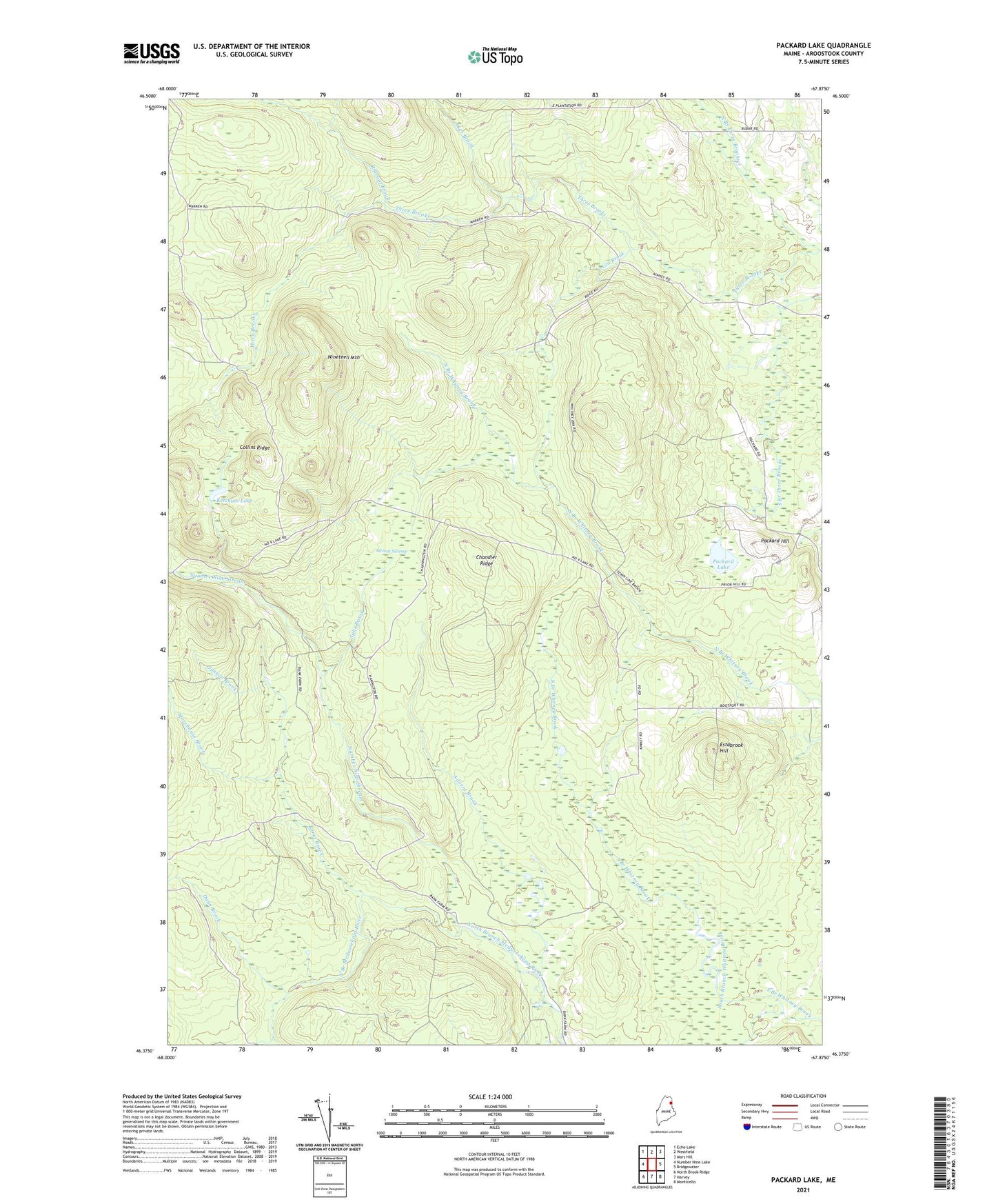
2024 topographic map quadrangle Packard Lake in the state of Maine. Scale: 1:24000. Based on the newly updated USGS 7.5' US Topo map series, this map is in the following counties: Aroostook. The map contains contour data, water features, and other items you are used to seeing on USGS maps, but also has updated roads and other features. This is the next generation of topographic maps. Printed on high-quality waterproof paper with UV fade-resistant inks.
Quads adjacent to this one:
West: Number Nine Lake
Northwest: Echo Lake
North: Westfield
Northeast: Mars Hill
East: Bridgewater
Southeast: Monticello
South: Harvey
Southwest: North Brook Ridge
This map covers the same area as the classic USGS quad with code o46067d8.
Contains the following named places: Advent Brook, Advent Swamp, Aker Brook, Burnt Brook, Chandler Ridge, Collins Ridge, Cox Patent, Dunn Brook, East School, Estabrook Hill, Gin Brook, Jimson Brook, Ketchum Lake, Morehouse Brook, Nineteen Mountain, Number Nine Stream, Packard Hill, Packard Lake, Rideout Brook, Split Brook, Sweets Trail, TD R2 WELS, Township of E, ZIP Code: 04734