MyTopo
Bridgewater Maine US Topo Map
Couldn't load pickup availability
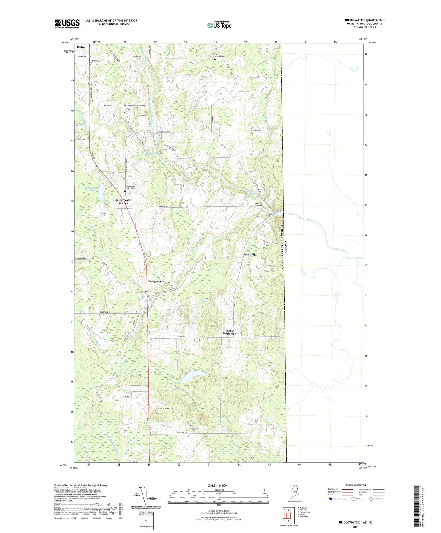
2024 topographic map quadrangle Bridgewater in the state of Maine. Scale: 1:24000. Based on the newly updated USGS 7.5' US Topo map series, this map is in the following counties: Aroostook. The map contains contour data, water features, and other items you are used to seeing on USGS maps, but also has updated roads and other features. This is the next generation of topographic maps. Printed on high-quality waterproof paper with UV fade-resistant inks.
Quads adjacent to this one:
West: Packard Lake
Northwest: Westfield
North: Mars Hill
South: Monticello
Southwest: Harvey
This map covers the same area as the classic USGS quad with code o46067d7.
Contains the following named places: Aroostook Campground, Blaine Census Designated Place, Boundary Line Cemetery, Bridgewater, Bridgewater Corner, Bridgewater Corner Cemetery, Bridgewater Fire Department, Bridgewater Grammar School, Bridgewater Post Office, Bunker Hill, Dead Brook, East Blaine Cemetery, Flagstaff School, Gin Brook, North Branch Three Brooks, North Branch Whitney Brook, Portland Lake, Prestile Stream, Riverside Camp, Robinson, Robinson Dam, Russell Brook, Sanborn Cemetery, Smith Cemetery, Snow Settlement, South Branch Three Brooks, South Branch Whitney Brook, Sugar Hill, Tapley Cemetery, Three Brooks, Town of Blaine, Town of Bridgewater, Whitehead Lake, Whitney Brook, Young Brook, ZIP Code: 04735