MyTopo
East Millinocket Maine US Topo Map
Couldn't load pickup availability
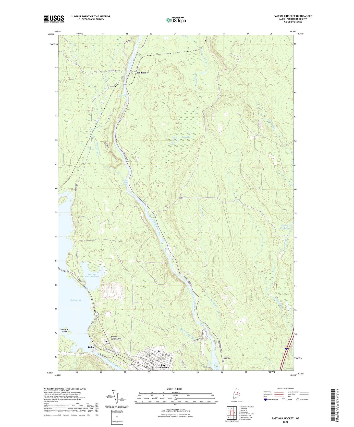
2024 topographic map quadrangle East Millinocket in the state of Maine. Scale: 1:24000. Based on the newly updated USGS 7.5' US Topo map series, this map is in the following counties: Penobscot. The map contains contour data, water features, and other items you are used to seeing on USGS maps, but also has updated roads and other features. This is the next generation of topographic maps. Printed on high-quality waterproof paper with UV fade-resistant inks.
Quads adjacent to this one:
West: Millinocket
Northwest: Whetstone Mountain
North: Stacyville
Northeast: Benedicta
East: Salmon Stream Lake
Southeast: Mattaseunk Lake
South: Medunkeunk Lake
Southwest: Nollesemic Lake
This map covers the same area as the classic USGS quad with code o45068f5.
Contains the following named places: Calvary Temple Assembly of God Church, Dolby, Dolby Dam, Dolby Pond, East Millinocket, East Millinocket Ambulance Service, East Millinocket Census Designated Place, East Millinocket Fire Department, East Millinocket Police Department, East Millinocket Post Office, East Millinocket Public Library, Grindstone, Grindstone Falls, Grindstone Road Cemetery, Hatham Bog, Hathaway Brook, Katahdin Regional Higher Education Center, Ledge Falls, Meadow Brook, Meadow Brook Rapids, Miner Brook, Opal Myrick Elementary School, Partridge Brook Flowage, Saint Peters Church, Schenck High School, Spectacle Island, Tots Brook, Town of East Millinocket, ZIP Codes: 04430, 04460