MyTopo
Stacyville Maine US Topo Map
Couldn't load pickup availability
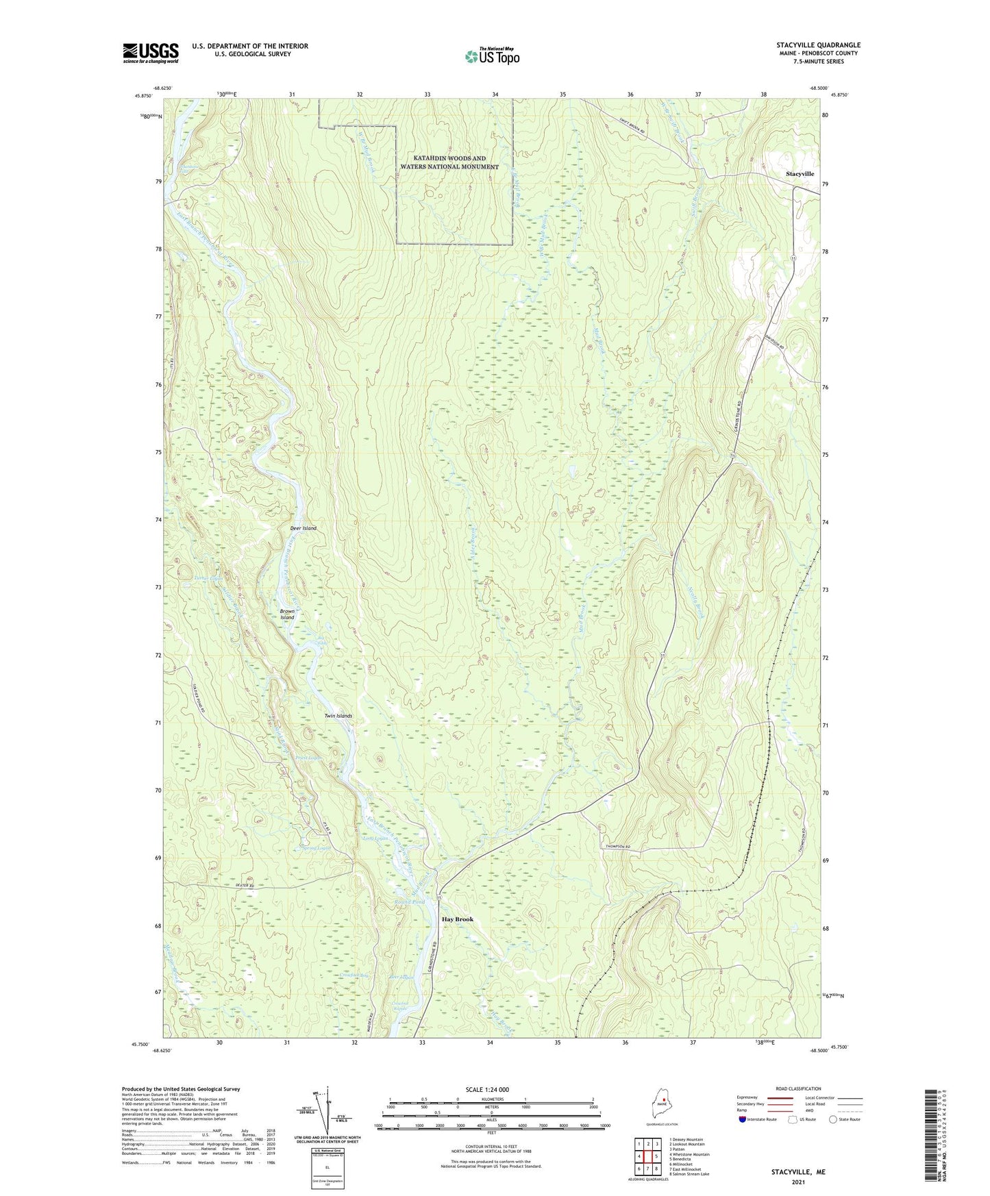
2024 topographic map quadrangle Stacyville in the state of Maine. Scale: 1:24000. Based on the newly updated USGS 7.5' US Topo map series, this map is in the following counties: Penobscot. The map contains contour data, water features, and other items you are used to seeing on USGS maps, but also has updated roads and other features. This is the next generation of topographic maps. Printed on high-quality waterproof paper with UV fade-resistant inks.
Quads adjacent to this one:
West: Whetstone Mountain
Northwest: Deasey Mountain
North: Lookout Mountain
Northeast: Patten
East: Benedicta
Southeast: Salmon Stream Lake
South: East Millinocket
Southwest: Millinocket
This map covers the same area as the classic USGS quad with code o45068g5.
Contains the following named places: Alder Brook, Beer Logan, Big Eddy, Brown Island, Crowfoot Bog, Crowfoot Rapids, Deer Island, East Branch Mud Brook, Hay Brook, Long Logan, Mud Brook, Neally Brook, Priest Logan, Round Pond, Soldier Brook, Spring Logan, Stacyville, Stink Brook, Swift Brook, Turner Logan, Twin Islands, West Branch Mud Brook, West Branch Swift Brook, Whetstone Falls, ZIP Code: 04777