MyTopo
Hay Lake Maine US Topo Map
Couldn't load pickup availability
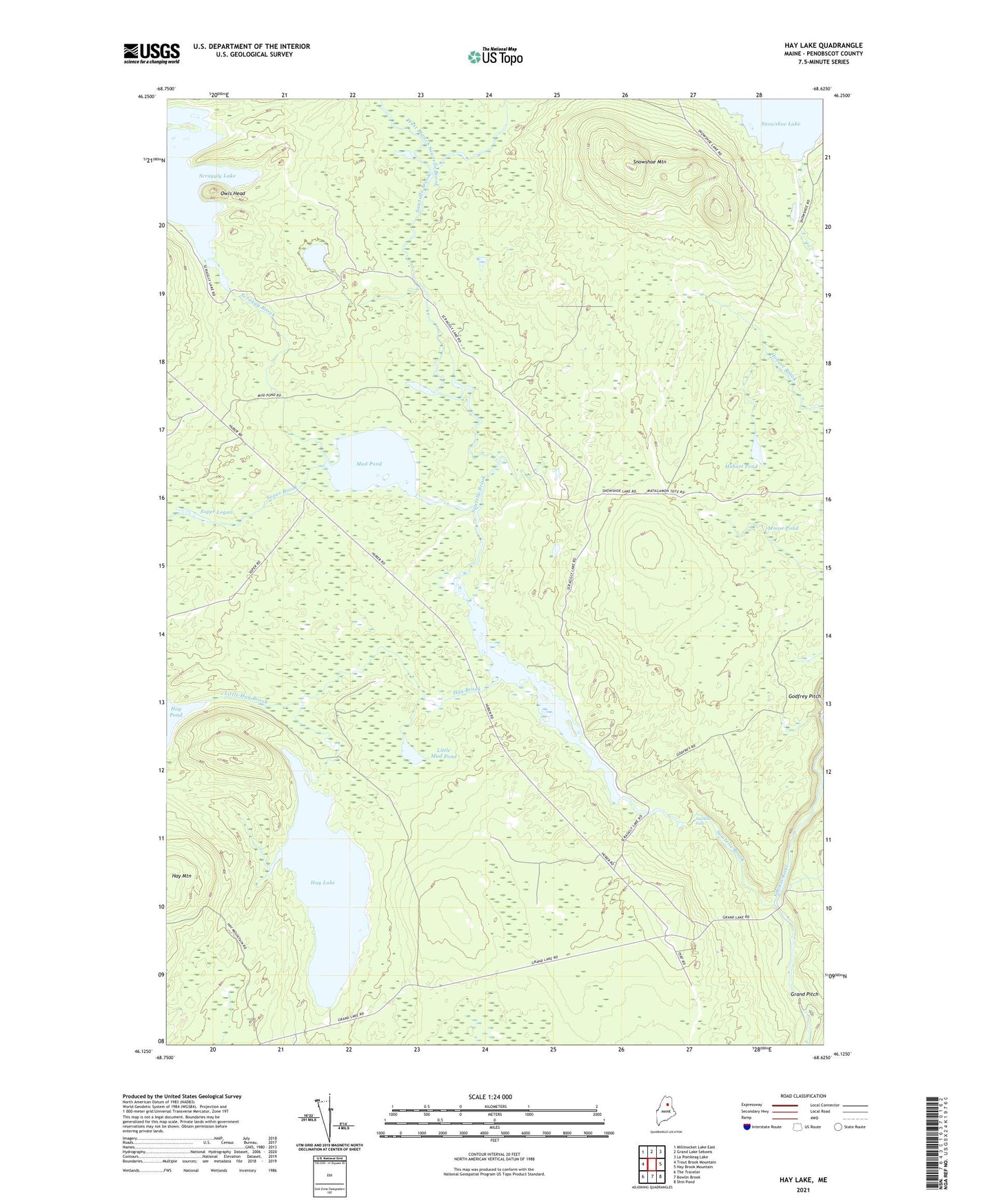
2024 topographic map quadrangle Hay Lake in the state of Maine. Scale: 1:24000. Based on the newly updated USGS 7.5' US Topo map series, this map is in the following counties: Penobscot. The map contains contour data, water features, and other items you are used to seeing on USGS maps, but also has updated roads and other features. This is the next generation of topographic maps. Printed on high-quality waterproof paper with UV fade-resistant inks.
Quads adjacent to this one:
West: Trout Brook Mountain
Northwest: Millinocket Lake East
North: Grand Lake Seboeis
Northeast: La Pomkeag Lake
East: Hay Brook Mountain
Southeast: Shin Pond
South: Bowlin Brook
Southwest: The Traveler
This map covers the same area as the classic USGS quad with code o46068b6.
Contains the following named places: Godfrey Pitch, Grand Pitch, Hay Brook, Hay Lake, Hay Mountain, Hobart Pond, Little Hay Brook, Little Mud Pond, Matagamon Tote Road, Moose Pond, Mud Pond, Owls Head, Sawtelle Brook, Sawtelle Deadwater, Sawtelle Deadwater Dam, Sawtelle Falls, Scraggy Brook, Seboeis Farm, Shin Brook, Snowshoe Lake Road, Snowshoe Mountain, Soper Brook, Soper Logan, T6 R7 WELS, West Branch Sawtelle Brook