MyTopo
Trout Brook Mountain Maine US Topo Map
Couldn't load pickup availability
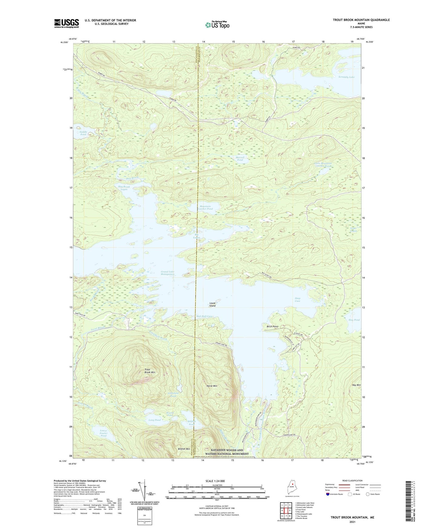
2024 topographic map quadrangle Trout Brook Mountain in the state of Maine. Scale: 1:24000. Based on the newly updated USGS 7.5' US Topo map series, this map is in the following counties: Penobscot, Piscataquis. The map contains contour data, water features, and other items you are used to seeing on USGS maps, but also has updated roads and other features. This is the next generation of topographic maps. Printed on high-quality waterproof paper with UV fade-resistant inks.
Quads adjacent to this one:
West: Frost Pond
Northwest: Millinocket Lake West
North: Millinocket Lake East
Northeast: Grand Lake Seboeis
East: Hay Lake
Southeast: Bowlin Brook
South: The Traveler
Southwest: Wassataquoik Lake
This map covers the same area as the classic USGS quad with code o46068b7.
Contains the following named places: Big Logan, Billfish Brook, Billfish Pond, Birch Point, Boody Brook, Deep Cove, First Lake, Grand Lake Dam, Grand Lake Matagamon, Hay Brook, Hay Brook Logan, Hay Pond, High Pond, Horse Mountain, Hub Hall Cove, Little Mountain Catcher Pond, Littlefield Brook, Littlefield Pond, Long Pond, Louse Island, Lower Fowler Pond, Matagamon Wilderness Campground, Morrell Pond, Mountain Catcher Pond, Norway Dam, Round Pond, Saddle Pond, Scraggly Lake, Second Lake, T6 R8 WELS, Trout Brook, Trout Brook Farm, Trout Brook Mountain