MyTopo
Millinocket Lake West Maine US Topo Map
Couldn't load pickup availability
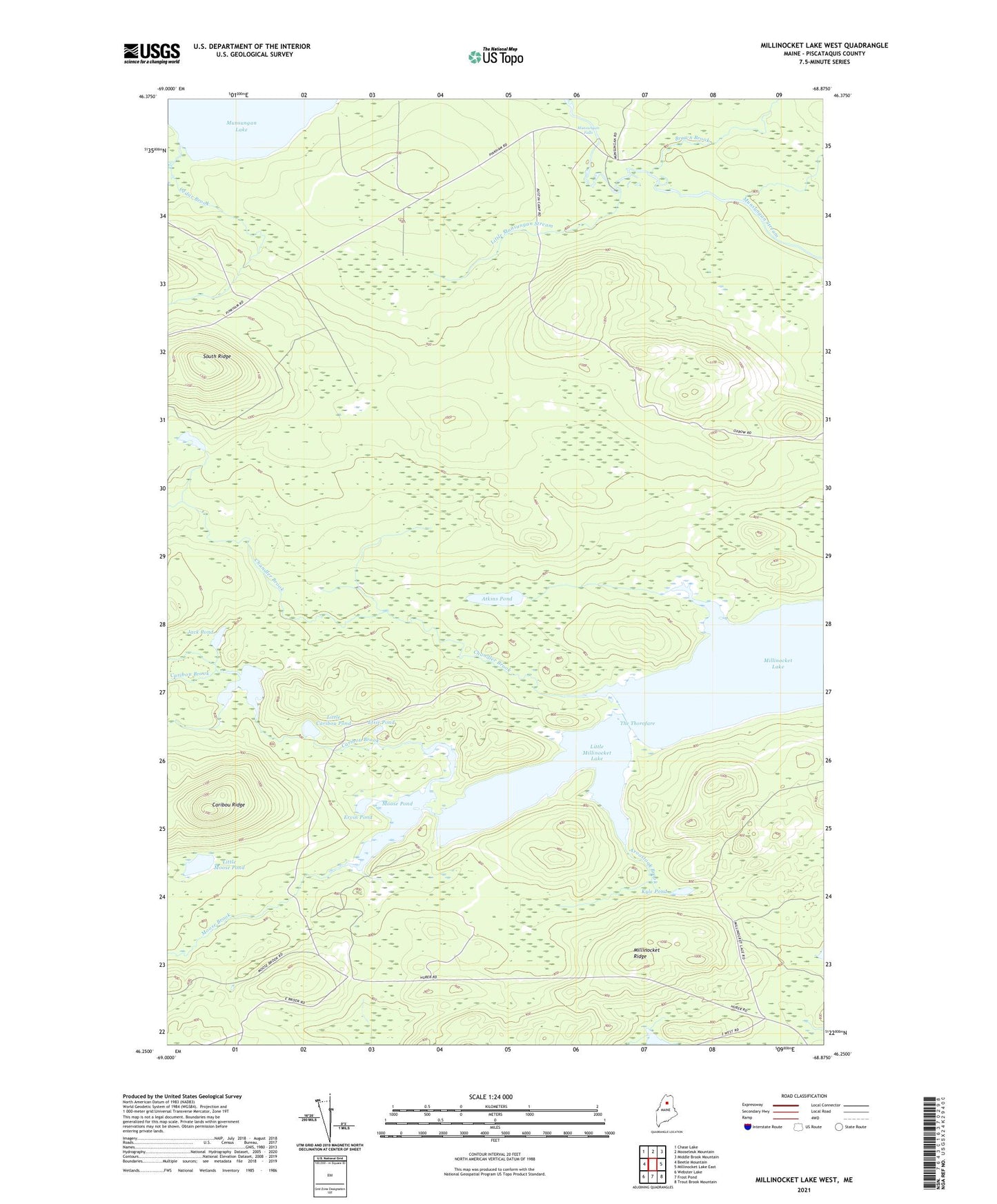
2021 topographic map quadrangle Millinocket Lake West in the state of Maine. Scale: 1:24000. Based on the newly updated USGS 7.5' US Topo map series, this map is in the following counties: Piscataquis. The map contains contour data, water features, and other items you are used to seeing on USGS maps, but also has updated roads and other features. This is the next generation of topographic maps. Printed on high-quality waterproof paper with UV fade-resistant inks.
Quads adjacent to this one:
West: Beetle Mountain
Northwest: Chase Lake
North: Mooseleuk Mountain
Northeast: Middle Brook Mountain
East: Millinocket Lake East
Southeast: Trout Brook Mountain
South: Frost Pond
Southwest: Webster Lake
Contains the following named places: Aroostook Brook, Atkins Pond, Big Caribou Pond, Brown Brook, Caribou Brook, Caribou Ridge, Cedar Brook, Chandler Brook, Elsie Pond, Ervin Pond, Jack Pond, Kyle Pond, Little Caribou Pond, Little Millinocket Lake, Little Moose Pond, Little Munsungan Stream, Millinocket Ridge, Moose Brook, Moose Pond, Munsungan Falls, Munsungan Lake, South Ridge, T7 R9 WELS, T8 R9 WELS, The Thorofare, Willard Brook, ZIP Code: 04732