MyTopo
Hardy Pond Maine US Topo Map
Couldn't load pickup availability
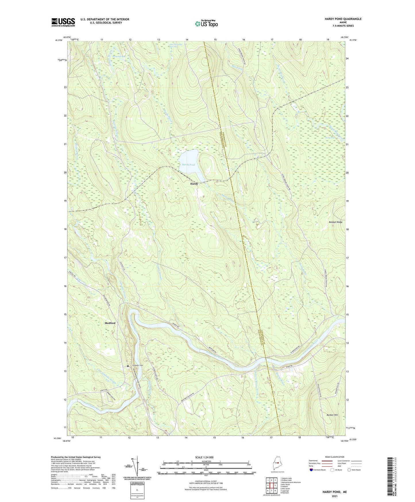
2024 topographic map quadrangle Hardy Pond in the state of Maine. Scale: 1:24000. Based on the newly updated USGS 7.5' US Topo map series, this map is in the following counties: Piscataquis, Penobscot. The map contains contour data, water features, and other items you are used to seeing on USGS maps, but also has updated roads and other features. This is the next generation of topographic maps. Printed on high-quality waterproof paper with UV fade-resistant inks.
Quads adjacent to this one:
West: Milo North
Northwest: Seboeis Lake
North: Endless Lake
Northeast: Mattamiscontis Mountain
East: Seboeis
Southeast: Howland
South: Lagrange
Southwest: Milo South
This map covers the same area as the classic USGS quad with code o45068c7.
Contains the following named places: Bog Brook, Bonnie Brook, Bunker Hill, Cold Stream, Hardy, Hardy Brook, Hardy Pond, Hardy Pond Trail, Horseshoe Bog, Little Schoodic Stream, Maxfield School, Meadow Brook, Medford, Packard Brook, Roberts Rocky Brook, Schoodic Cemetery, Schoodic Stream, Scutaze Stream, Scutaze Trail, Sweat Bog, Town of Maxfield, Town of Medford