MyTopo
Misery Knob Maine US Topo Map
Couldn't load pickup availability
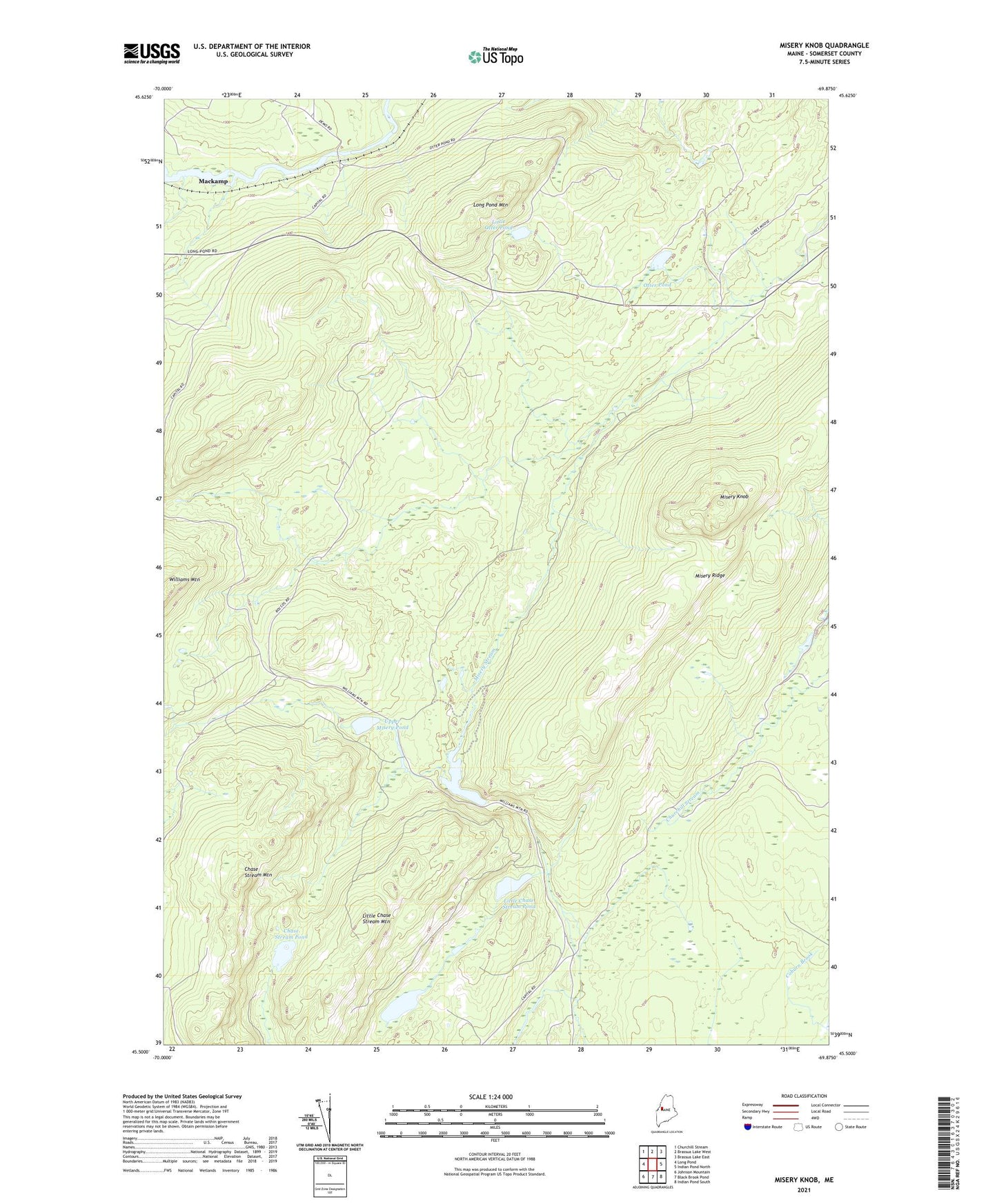
2021 topographic map quadrangle Misery Knob in the state of Maine. Scale: 1:24000. Based on the newly updated USGS 7.5' US Topo map series, this map is in the following counties: Somerset. The map contains contour data, water features, and other items you are used to seeing on USGS maps, but also has updated roads and other features. This is the next generation of topographic maps. Printed on high-quality waterproof paper with UV fade-resistant inks.
Quads adjacent to this one:
West: Long Pond
Northwest: Churchill Stream
North: Brassua Lake West
Northeast: Brassua Lake East
East: Indian Pond North
Southeast: Indian Pond South
South: Black Brook Pond
Southwest: Johnson Mountain
Contains the following named places: Chase Stream Mountain, Chase Stream Pond, Lanigan Dam, Little Chase Stream Mountain, Little Chase Stream Pond, Little Otter Pond, Long Pond Dam, Long Pond Mountain, Milliken Farm, Misery Knob, Misery Pond, Misery Ridge, Misery Township, North Branch Chase Stream, North Branch Misery Stream, Otter Pond, Sandwich Academy Grant Township, Somerset County, Ten Thousand Acre Pond, Trout Brook, Upper Misery Pond, West Branch Misery Stream