MyTopo
Monson West Maine US Topo Map
Couldn't load pickup availability
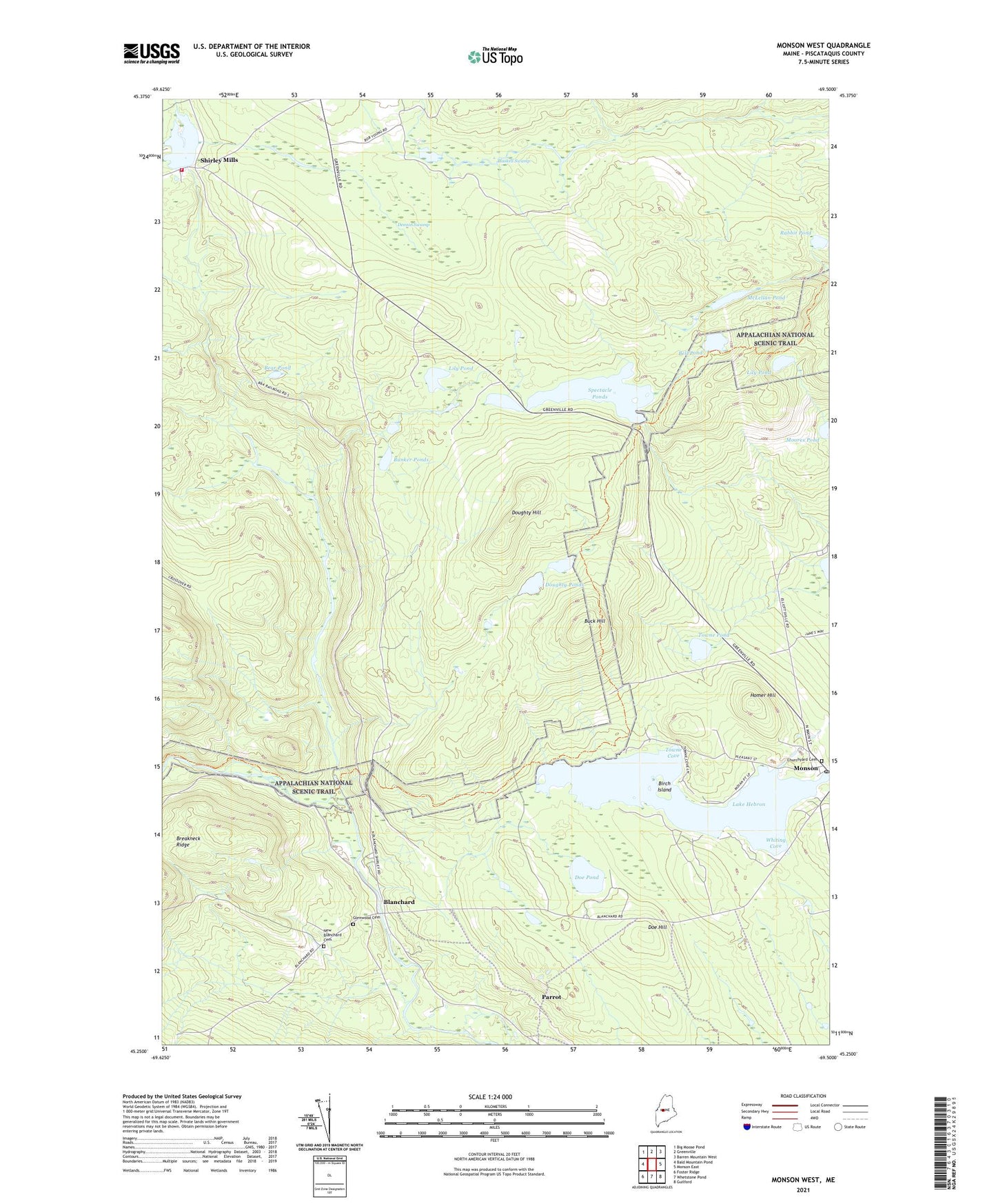
2021 topographic map quadrangle Monson West in the state of Maine. Scale: 1:24000. Based on the newly updated USGS 7.5' US Topo map series, this map is in the following counties: Piscataquis. The map contains contour data, water features, and other items you are used to seeing on USGS maps, but also has updated roads and other features. This is the next generation of topographic maps. Printed on high-quality waterproof paper with UV fade-resistant inks.
Quads adjacent to this one:
West: Bald Mountain Pond
Northwest: Big Moose Pond
North: Greenville
Northeast: Barren Mountain West
East: Monson East
Southeast: Guilford
South: Whetstone Pond
Southwest: Foster Ridge
Contains the following named places: Bear Pond, Bell Pond, Birch Island, Blackstone Brook, Blanchard, Brackett Brook, Buck Hill, Bunker Ponds, Bunker Stream, Burma School, Churchyard Cemetery, Dennin Brook, Dennin Swamp, Doe Hill, Doe Pond, Doughty Hill, Doughty Ponds, East Branch Piscataquis River, Glenwood Cemetery, Gully Brook, Haskell Swamp, Homer Hill, Jackson Brook, Lake Hebron, Lily Pond, Little Wilson Deadwater, Lower Shirley Corner, McLellan Pond, Monson, Monson Community Church, Monson Elementary School, Monson Post Office, Moores Pond, New Blanchard Cemetery, Parrot, Rabbit Pond, Shirley Mills, Shirley Mills Post Office, Shirley Pond, Shirley Pond Dam, Shirley Volunteer Fire Department, Spectacle Ponds, Town of Monson, Towne Cove, Towne Pond, West Branch Piscataquis River, Whiting Cove