MyTopo
Bald Mountain Pond Maine US Topo Map
Couldn't load pickup availability
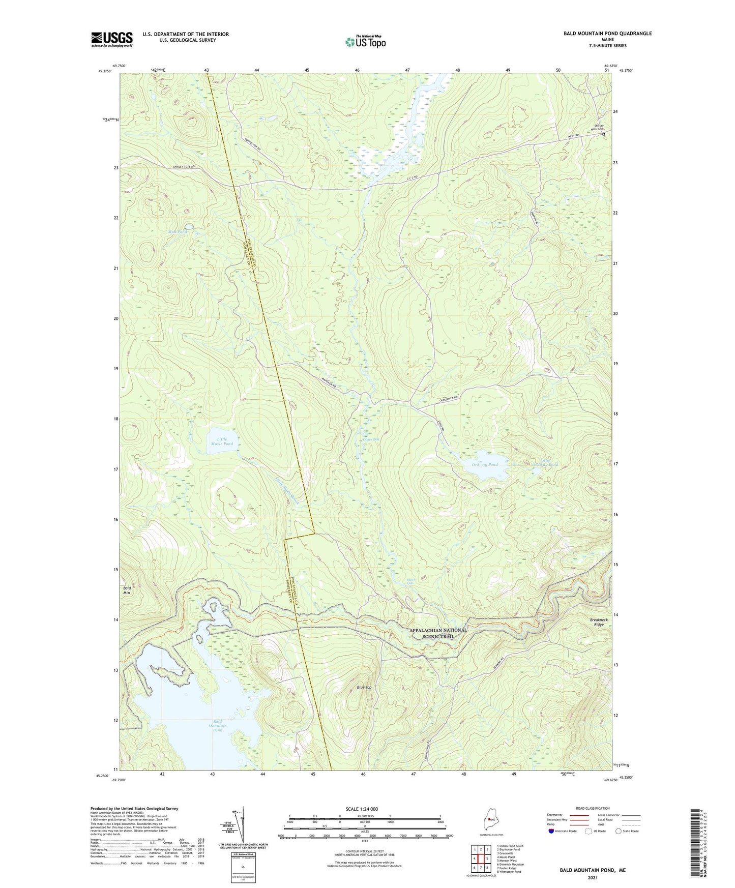
2024 topographic map quadrangle Bald Mountain Pond in the state of Maine. Scale: 1:24000. Based on the newly updated USGS 7.5' US Topo map series, this map is in the following counties: Piscataquis, Somerset. The map contains contour data, water features, and other items you are used to seeing on USGS maps, but also has updated roads and other features. This is the next generation of topographic maps. Printed on high-quality waterproof paper with UV fade-resistant inks.
Quads adjacent to this one:
West: Moxie Pond
Northwest: Indian Pond South
North: Big Moose Pond
Northeast: Greenville
East: Monson West
Southeast: Whetstone Pond
South: Foster Ridge
Southwest: Dimmick Mountain
This map covers the same area as the classic USGS quad with code o45069c6.
Contains the following named places: Bald Mountain Pond, Bald Mountain Stream, Big Bennett Brook, Blue Top, Breakneck Ridge, East Inlet Bald Mountain Pond, Hatch Falls, Little Bennett Brook, Little Moxie Brook, Little Moxie Pond, Little Ordway Pond, Lord Brook, Marble Brook, Mud Pond, Mud Pond Brook, Oakes Bog, Ordway Brook, Ordway Pond, Shannon Brook, Shirley Elementary School, Shirley Mills Cemetery, Shirley United Methodist Church, Stricklin Brook, Town of Shirley, Unorganized Territory of Blanchard, West Shirley Bog, ZIP Code: 04485