MyTopo
Big Moose Pond Maine US Topo Map
Couldn't load pickup availability
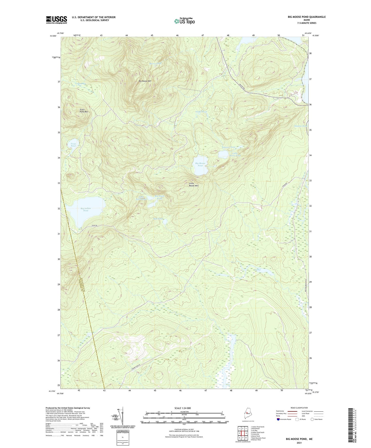
2024 topographic map quadrangle Big Moose Pond in the state of Maine. Scale: 1:24000. Based on the newly updated USGS 7.5' US Topo map series, this map is in the following counties: Piscataquis, Somerset. The map contains contour data, water features, and other items you are used to seeing on USGS maps, but also has updated roads and other features. This is the next generation of topographic maps. Printed on high-quality waterproof paper with UV fade-resistant inks.
Quads adjacent to this one:
West: Indian Pond South
Northwest: Indian Pond North
North: Moosehead
Northeast: Lily Bay
East: Greenville
Southeast: Monson West
South: Bald Mountain Pond
Southwest: Moxie Pond
Contains the following named places: Big Indian Pond, Big Moose Mountain, Big Moose Mountain Lookout Tower, Big Moose Mountain Trail, Big Moose Pond, Big Notch Pond, Gulliver Brook, Intake Pond, Intake Trail, Ira Bog, Little Moose Brook, Little Moose Mountain, Little Moose Pond, Little Notch Pond, Mansell Brook, Middle Moose Brook, Mirror Pond, Moore Bog, Moose Brook, Moosehead Junction Township, Mud Pond, Mud Pond Brook, Papoose Pond, Trout Pond, Trout Pond Mountain, ZIP Code: 04442