MyTopo
Monticello Maine US Topo Map
Couldn't load pickup availability
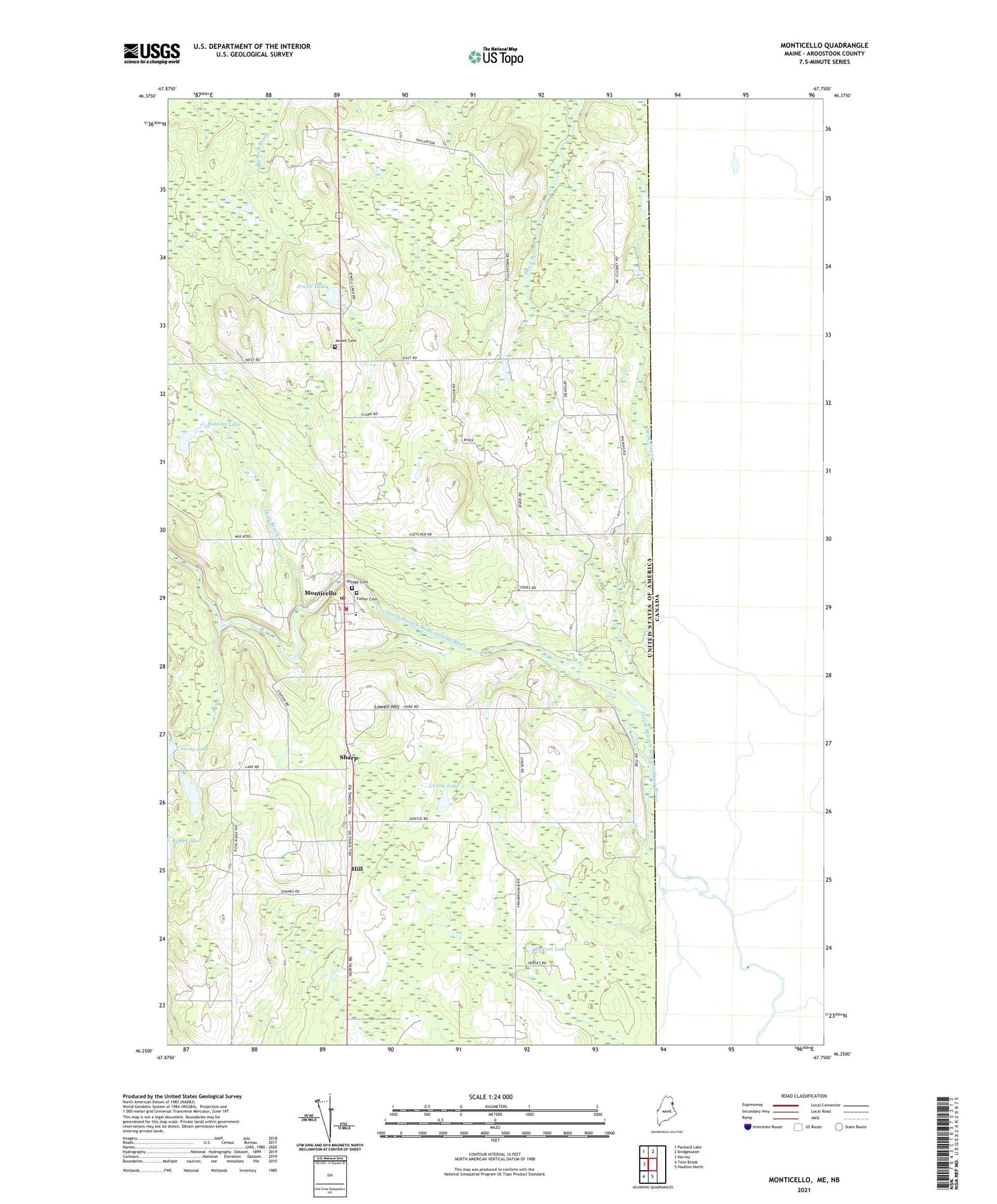
2024 topographic map quadrangle Monticello in the state of Maine. Scale: 1:24000. Based on the newly updated USGS 7.5' US Topo map series, this map is in the following counties: Aroostook. The map contains contour data, water features, and other items you are used to seeing on USGS maps, but also has updated roads and other features. This is the next generation of topographic maps. Printed on high-quality waterproof paper with UV fade-resistant inks.
Quads adjacent to this one:
West: Harvey
Northwest: Packard Lake
North: Bridgewater
South: Houlton North
Southwest: Twin Brook
This map covers the same area as the classic USGS quad with code o46067c7.
Contains the following named places: Britton Lake, Britton School, Calvary Pentecostal Church, Camp Williams, Dead Stream, Foster Cemetery, Gentle Lake, Hill, Hoyt Brook, Jewell Cemetery, Jewell Lake, Jewells Corner, Lake School, Lowell Hill, Monticello, Monticello Fire Department, Monticello Post Office, Monticello Station, Monticello United Methodist Church, Monticello Wesleyan Church, Rideout Lake, Ross School, Sharp, Town of Monticello, Village Cemetery, Wellington School, WXME-AM (Monticello)