MyTopo
New Sharon Maine US Topo Map
Couldn't load pickup availability
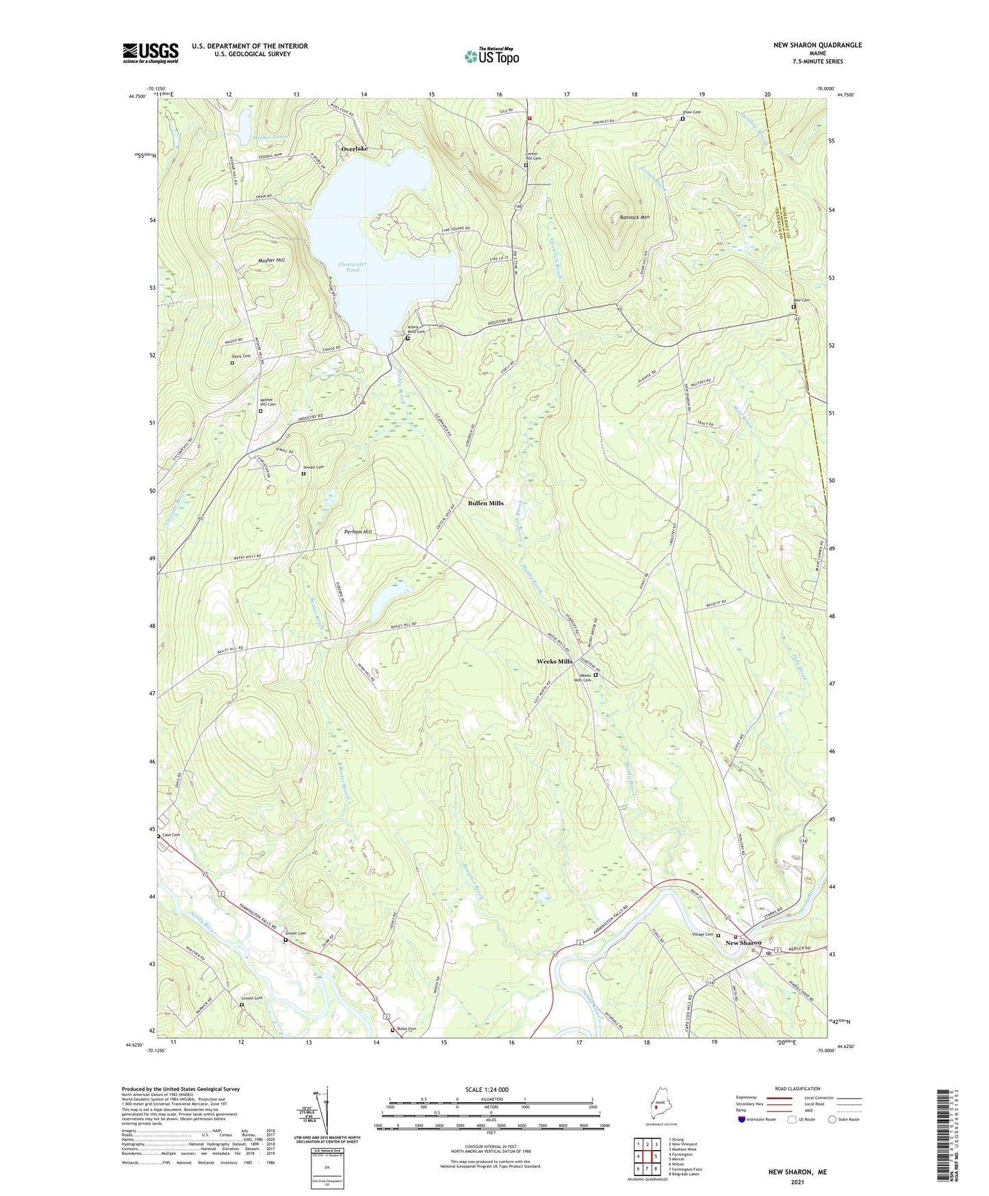
2024 topographic map quadrangle New Sharon in the state of Maine. Scale: 1:24000. Based on the newly updated USGS 7.5' US Topo map series, this map is in the following counties: Franklin, Somerset. The map contains contour data, water features, and other items you are used to seeing on USGS maps, but also has updated roads and other features. This is the next generation of topographic maps. Printed on high-quality waterproof paper with UV fade-resistant inks.
Quads adjacent to this one:
West: Farmington
Northwest: Strong
North: New Vineyard
Northeast: Madison West
East: Mercer
Southeast: Belgrade Lakes
South: Farmington Falls
Southwest: Wilton
This map covers the same area as the classic USGS quad with code o44070f1.
Contains the following named places: Allens Mills, Allens Mills Cemetery, Bannock Mountain, Beales Brook, Blake Cemetery, Bragdon Brook, Bullen Mills, Center Hill Cemetery, Clearwater Pond, Goodrich Brook, Goodrich Corner, Gower Cemetery, Industry Volunteer Fire Department, Jim Ditzler Memorial Library, Lowell Cemetery, Mosher Hill, Mosher Hill Cemetery, Mosher Pond, Muddy Brook, New Sharon, New Sharon Congregational Church-United Church of Christ, New Sharon Fire Station, New Sharon Post Office, Overlake, Perham Hill, Pike Cemetery, Riverside Cemetery, Sewall Cemetery, Shaw Cemetery, Town of New Sharon, Village Cemetery, Weeks Mills, Weeks Mills Cemetery, Wendall Davis Cemetery, ZIP Code: 04938