MyTopo
Farmington Falls Maine US Topo Map
Couldn't load pickup availability
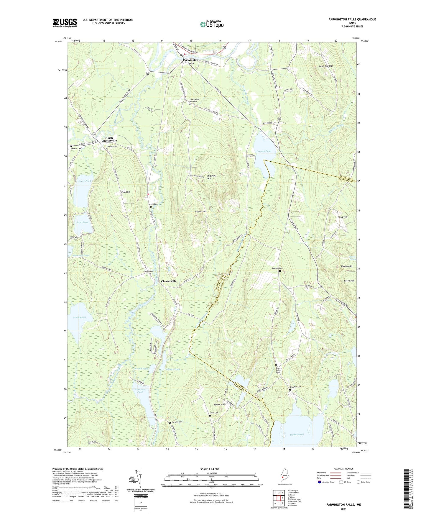
2024 topographic map quadrangle Farmington Falls in the state of Maine. Scale: 1:24000. Based on the newly updated USGS 7.5' US Topo map series, this map is in the following counties: Franklin, Kennebec. The map contains contour data, water features, and other items you are used to seeing on USGS maps, but also has updated roads and other features. This is the next generation of topographic maps. Printed on high-quality waterproof paper with UV fade-resistant inks.
Quads adjacent to this one:
West: Wilton
Northwest: Farmington
North: New Sharon
Northeast: Mercer
East: Belgrade Lakes
Southeast: Readfield
South: Fayette
Southwest: Livermore Falls
This map covers the same area as the classic USGS quad with code o44070e1.
Contains the following named places: Blabon Hill, Black Pond, Cape Cod Hill, Cape Cod Hill School, Center Cemetery, Chapman Cemetery, Chesterville, Chesterville Hill Cemetery, Chesterville School, Chesterville Volunteer Fire Station, Chesterville Wildlife Management Area, Crowell Pond, Eaton Mountain, Egypt Pond, Farmington Falls, Farmington Falls Fire Department, Farmington Falls Post Office, Farmington Falls Union Baptist Church, Fellows Pond, Franklin Cemetery, Horseshoe Pond, Little Norridgewock Stream, Little Norridgewock Stream Reservoir, Locke Pond, Lowell Cemetery, McGurdy Stream, Mercer Dam, Norcross Cemetery, Norcross Pond, North Chesterfield Cemetery, North Chesterville, North Pond, North Vienna Church, Old Bluff Hill, Robinson Pond, Round Pond, Sanborn Hill, Sand Pond, Seaveys Corner, Seaveys Corner Cemetery, Soper Cemetery, Sugar Brook, Town of Chesterville, Town of Vienna, Vienna Mountain, Webster Cemetery, Whittier Brook, Whittier Pond, Wilson Stream, York Hill, Zion Hill, ZIP Code: 04940