MyTopo
New Vineyard Maine US Topo Map
Couldn't load pickup availability
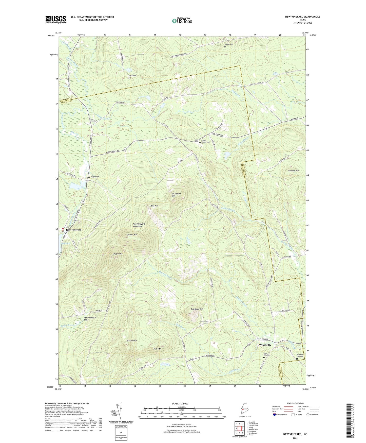
2021 topographic map quadrangle New Vineyard in the state of Maine. Scale: 1:24000. Based on the newly updated USGS 7.5' US Topo map series, this map is in the following counties: Franklin, Somerset. The map contains contour data, water features, and other items you are used to seeing on USGS maps, but also has updated roads and other features. This is the next generation of topographic maps. Printed on high-quality waterproof paper with UV fade-resistant inks.
Quads adjacent to this one:
West: Strong
Northwest: Kingfield
North: New Portland
Northeast: Embden Pond
East: Madison West
Southeast: Mercer
South: New Sharon
Southwest: Farmington
Contains the following named places: Barker Brook, Bauds Pond, Bauds Pond Dam, Boardman - True Cemetery, Boardman Mountain, Carsley Cemetery, Caswell Mountain, Daggett Cemetery, Fish Brook, Gamape Hill, Great Works, Greenwood Brook, Greenwood Stream, Griffin Mountain, Hall Brook, Ick Norton Mountain, Little Mountain, Luce Brook, Mantor Cemetery, Mill Pond, Mitchell Brook, New Vineyard, New Vineyard Basin, New Vineyard Mountains, New Vineyard Post Office, New Vineyard Public Library, New Vineyard Volunteer Fire Department, Norton Mountain, Pratt Corner Cemetery, Pratt Corner School, Rand School, Strickland Hill, Talcott Corner Cemetery, Talcott School, Town of Industry, Town of New Vineyard, True Mountain, West Mills, ZIP Code: 04956