MyTopo
Andover Maine US Topo Map
Couldn't load pickup availability
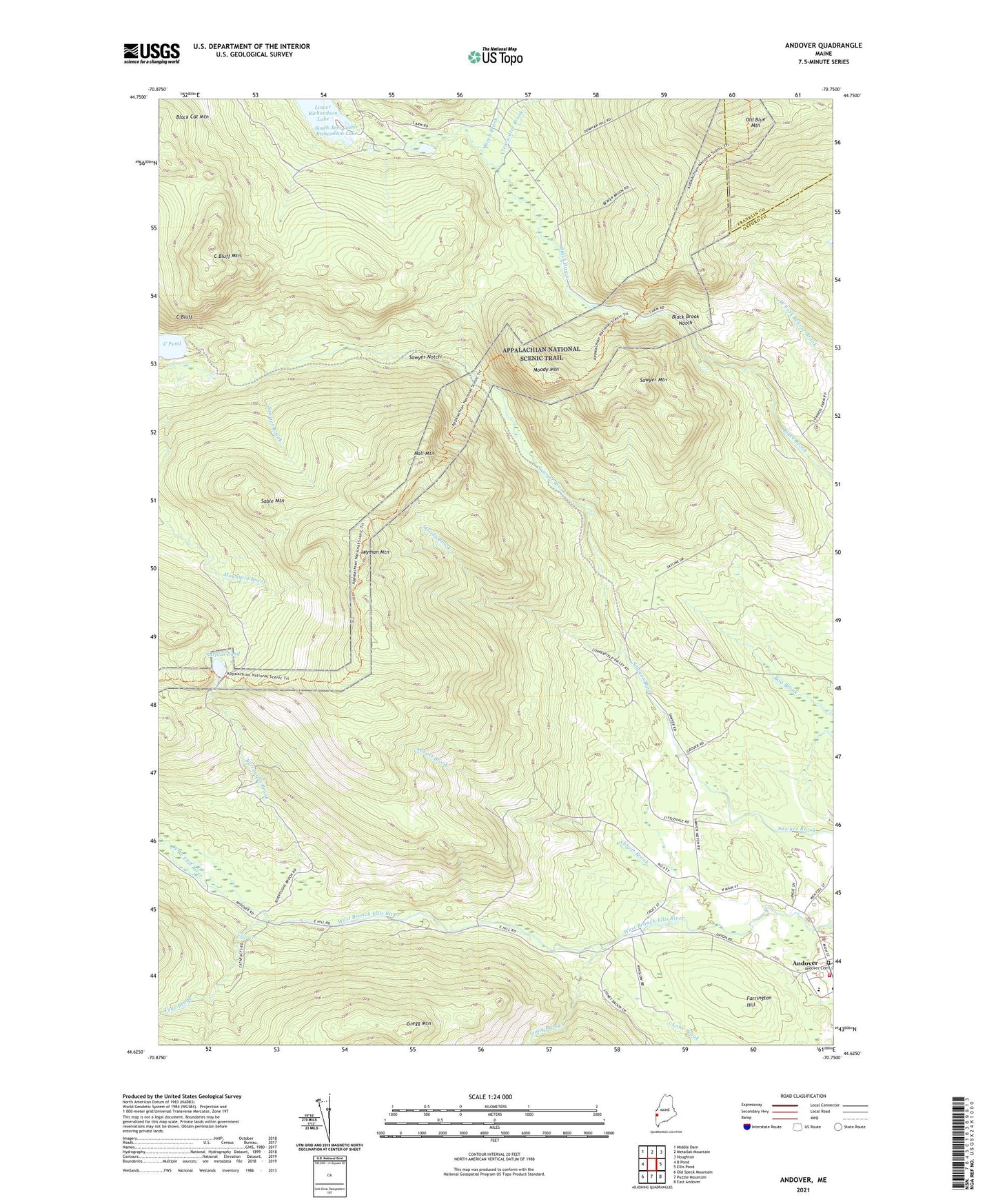
2024 topographic map quadrangle Andover in the state of Maine. Scale: 1:24000. Based on the newly updated USGS 7.5' US Topo map series, this map is in the following counties: Oxford, Franklin. The map contains contour data, water features, and other items you are used to seeing on USGS maps, but also has updated roads and other features. This is the next generation of topographic maps. Printed on high-quality waterproof paper with UV fade-resistant inks.
Quads adjacent to this one:
West: B Pond
Northwest: Middle Dam
North: Metallak Mountain
Northeast: Houghton
East: Ellis Pond
Southeast: East Andover
South: Puzzle Mountain
Southwest: Old Speck Mountain
This map covers the same area as the classic USGS quad with code o44070f7.
Contains the following named places: Abbott Brook, Andover, Andover Cemetery, Andover Fire Department, Andover North Surplus Township, Andover Public Library, Andover School, Birch Brook, Black Brook Notch, Burroughs Brook, C Bluff, C Bluff Mountain, Calvary Congregational Church, Clearwater Brook, Farrington Hill, Frye Brook, Gregg Mountain, Hall Mountain, Moody Brook, Moody Mountain, Old Blue Mountain, Sable Mountain, Sawyer Mountain, Sawyer Notch, Stony Brook, Surplus Pond, The Cataracts, Wyman Mountain, ZIP Code: 04216