MyTopo
Pittsfield Maine US Topo Map
Couldn't load pickup availability
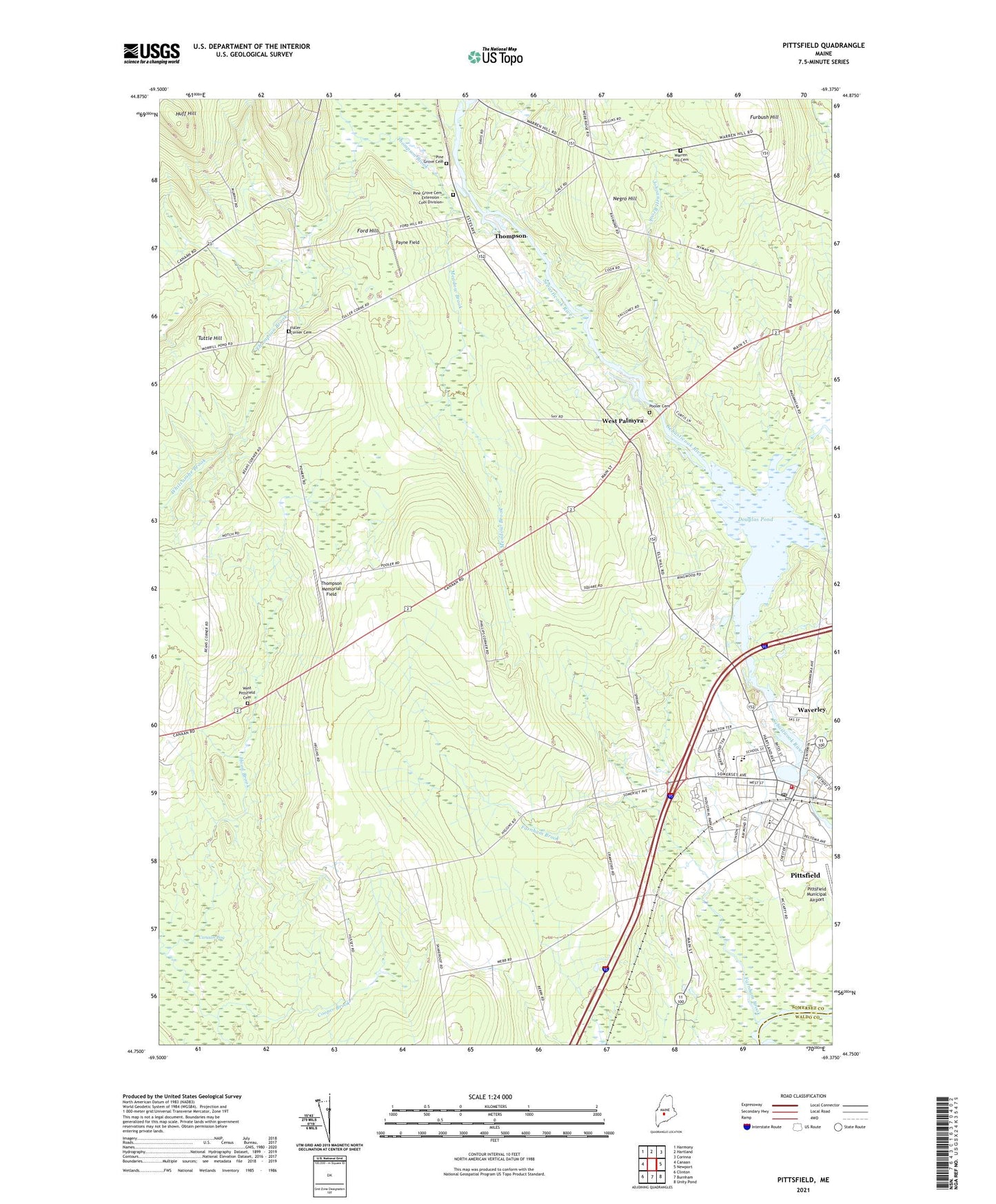
2021 topographic map quadrangle Pittsfield in the state of Maine. Scale: 1:24000. Based on the newly updated USGS 7.5' US Topo map series, this map is in the following counties: Somerset, Waldo. The map contains contour data, water features, and other items you are used to seeing on USGS maps, but also has updated roads and other features. This is the next generation of topographic maps. Printed on high-quality waterproof paper with UV fade-resistant inks.
Quads adjacent to this one:
West: Canaan
Northwest: Harmony
North: Hartland
Northeast: Corinna
East: Newport
Southeast: Unity Pond
South: Burnham
Southwest: Clinton
Contains the following named places: Alternative Education School, Bowley Pond, Burton Corner, Douglas Pond, Ell School, Emerson Corner, Farnham Brook, First Baptist Church, Fogg Brook, Ford Hill, Fuller Corner Cemetery, Furbush Hill, Gale School, Hood Brook, Huff Hill, Indian Stream, Johnson W Parks Golf Course, Johonnett Brook, Madawaska Brook, Maine Central Institute, Manson Corner, Manson Park School, Marie Bradford School, Mason Park, Meadow Brook, Mill Pond, Mosher Corner, Negro Hill, Palmyra Consolidated School, Payne Field, Phillips Corner, Pine Grove Cemetery, Pioneer Dam, Pittsfield, Pittsfield Census Designated Place, Pittsfield Fire Department, Pittsfield Municipal Airport, Pittsfield Police Department, Pittsfield Post Office, Pittsfield Public Library, Pittsfield Universalist Church, Pooler Cemetery, Saint Agnes Parochial School, South Bog Stream, Thompson, Thompson Brook, Thompson Corner, Thompson Memorial Field, Tilton Corner, Town of Pittsfield, Tuttle Hill, Upper Dam, Vickery School, Warren Hill Cemetery, Warsaw Middle School, Waverley, Weeks Corner, West Palmyra, West Pittsfield Cemetery, ZIP Code: 04967