MyTopo
Clifford Lake Maine US Topo Map
Couldn't load pickup availability
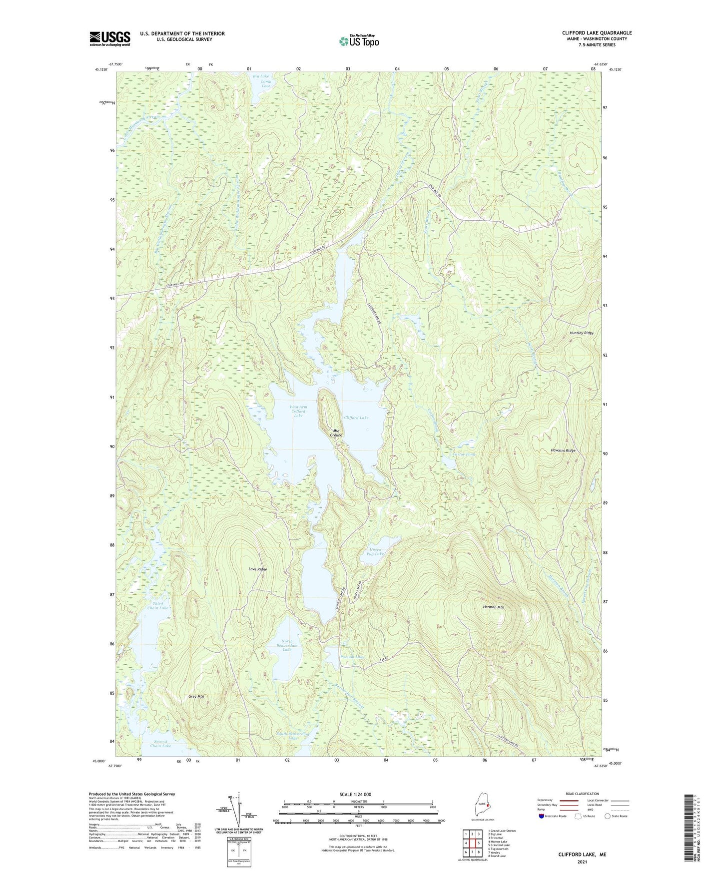
2024 topographic map quadrangle Clifford Lake in the state of Maine. Scale: 1:24000. Based on the newly updated USGS 7.5' US Topo map series, this map is in the following counties: Washington. The map contains contour data, water features, and other items you are used to seeing on USGS maps, but also has updated roads and other features. This is the next generation of topographic maps. Printed on high-quality waterproof paper with UV fade-resistant inks.
Quads adjacent to this one:
West: Monroe Lake
Northwest: Grand Lake Stream
North: Big Lake
Northeast: Princeton
East: Crawford Lake
Southeast: Round Lake
South: Wesley
Southwest: Tug Mountain
This map covers the same area as the classic USGS quad with code o45067a6.
Contains the following named places: Big Wallamatogue Stream, Carloe Brook, Carloe Pond, Clifford Dam, Clifford Lake, East Arm Clifford Lake, Grey Mountain, Harmon Mountain, Hawkins Ridge, Hosea Pug Lake, Huntley Ridge, Little Wallamatogue Stream, Love Ridge, Middle Ground, North Beaverdam Lake, Possum Lake, Silver Pug Lake, T26 ED BPP, Third Chain Lake, West Arm Clifford Lake