MyTopo
Greenbush Maine US Topo Map
Couldn't load pickup availability
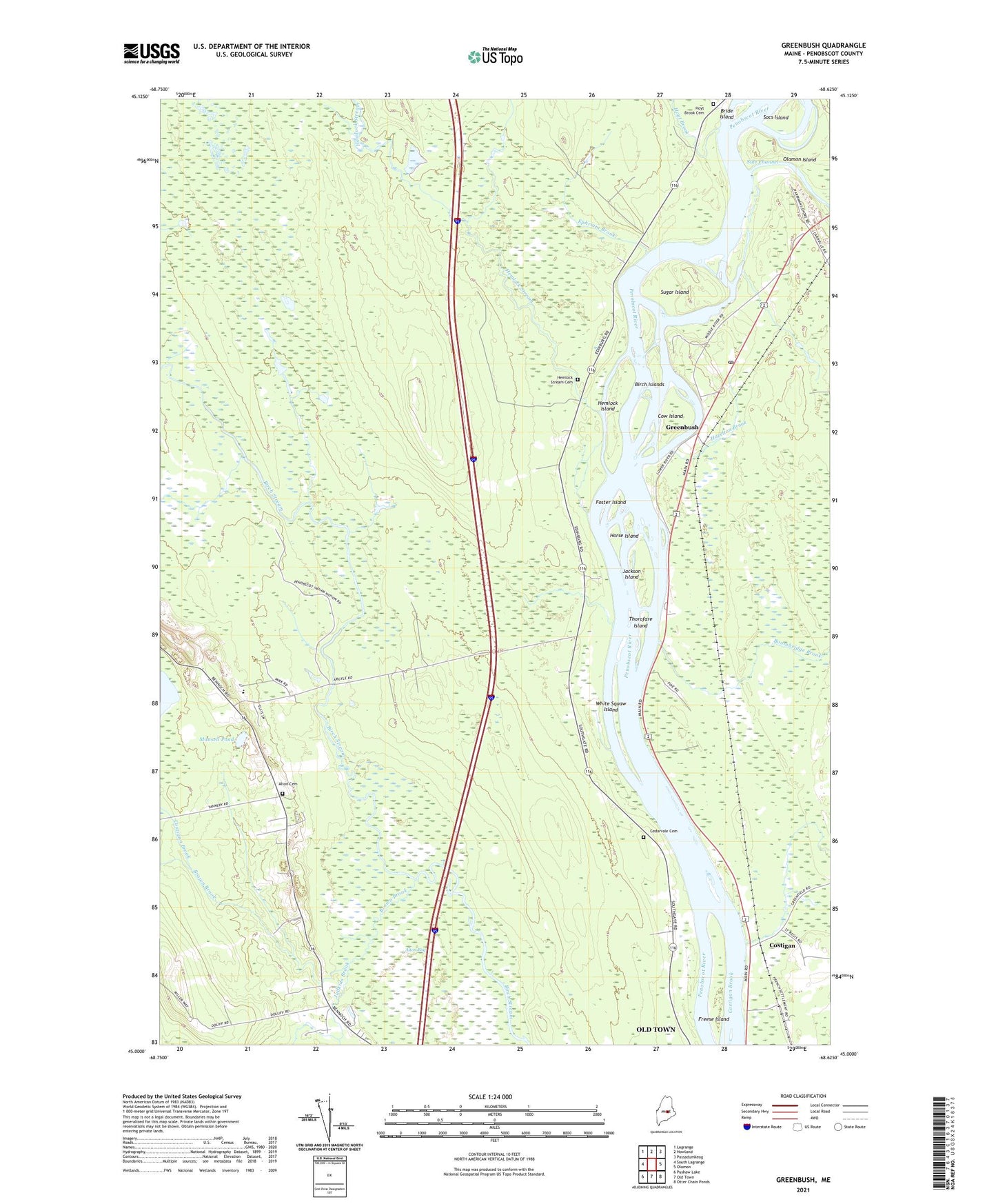
2024 topographic map quadrangle Greenbush in the state of Maine. Scale: 1:24000. Based on the newly updated USGS 7.5' US Topo map series, this map is in the following counties: Penobscot. The map contains contour data, water features, and other items you are used to seeing on USGS maps, but also has updated roads and other features. This is the next generation of topographic maps. Printed on high-quality waterproof paper with UV fade-resistant inks.
Quads adjacent to this one:
West: South Lagrange
Northwest: Lagrange
North: Howland
Northeast: Passadumkeag
East: Olamon
Southeast: Otter Chain Ponds
South: Old Town
Southwest: Pushaw Lake
This map covers the same area as the classic USGS quad with code o45068a6.
Contains the following named places: Alton, Alton Bog, Alton Cemetery, Alton Church, Alton Elementary School, Argyle, Birch Islands, Boombridge Brook, Bride Island, Brown Brook, Cedarvale Cemetery, Costigan, Costigan Brook, Cow Island, Ephriam Brook, Foster Island, Freese Island, Greenbush, Greenbush Post Office, Hazelton Brook, Hemlock Island, Hemlock Stream, Hemlock Stream Cemetery, Horse Island, Hoyt Brook, Hoyt Brook Cemetery, Jackson Island, Judkins Brook, Mansell Pond, Socs Island, Stevens Brook, Sugar Island, Thorofare Island, Township of Argyle, Unorganized Territory of Argyle, WBZN-FM (Old Town), White Squaw Island, ZIP Code: 04468