MyTopo
Razorville Maine US Topo Map
Couldn't load pickup availability
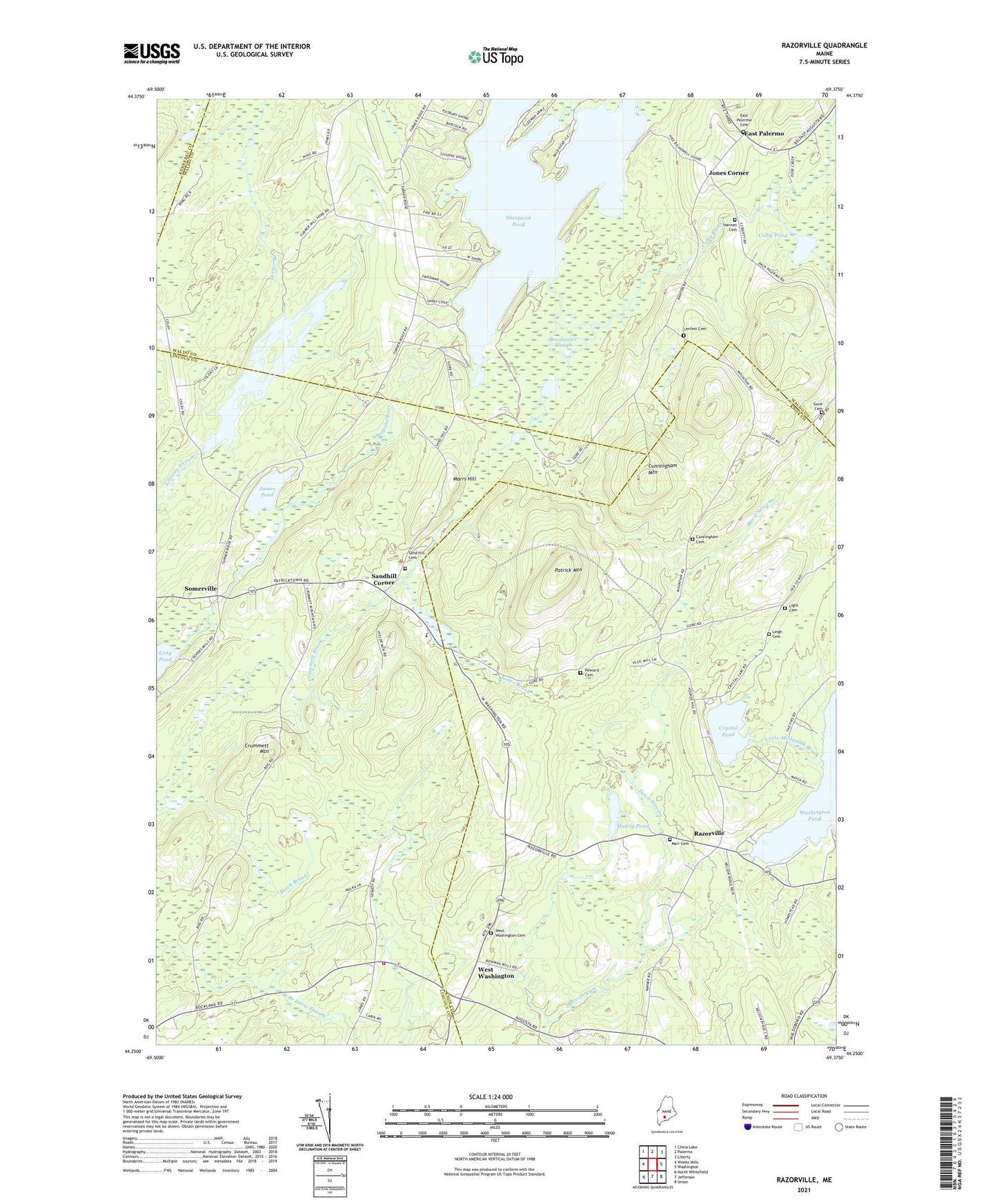
2021 topographic map quadrangle Razorville in the state of Maine. Scale: 1:24000. Based on the newly updated USGS 7.5' US Topo map series, this map is in the following counties: Knox, Lincoln, Waldo, Kennebec. The map contains contour data, water features, and other items you are used to seeing on USGS maps, but also has updated roads and other features. This is the next generation of topographic maps. Printed on high-quality waterproof paper with UV fade-resistant inks.
Quads adjacent to this one:
West: Weeks Mills
Northwest: China Lake
North: Palermo
Northeast: Liberty
East: Washington
Southeast: Union
South: Jefferson
Southwest: North Whitefield
Contains the following named places: Colby Brook, Colby Mills Dam, Colby Pond, Crummett Brook, Crummett Mountain, Crystal Pond, Cunningham Mountain, Deadwater Slough, East Palermo, East Palermo Cemetery, Eastman Cemetery, Gove Cemetery, Hannan Cemetery, Hibberts Corner, Hibberts Gore, Howard Cemetery, James Pond, Jones Brook, Jones Corner, Lenfest Cemetery, Linscott Branch, Marrs Hill, Muddy Pond, Palermo Community Library, Palermo Volunteer Fire Department East Palermo Station, Patrick Mountain, Razorville, Sand Hill Cemetery, Sandhill Corner, Sandhill School, Sheepscot Pond, Sheepscot Pond Dam, Sheepscot Valley School, Somerville, Somerville Fire Station, Somerville Town Library, Town of Somerville, Town of Washington, Turner Branch, Turner Pond, West Washington, ZIP Code: 04574