MyTopo
Jefferson Maine US Topo Map
Couldn't load pickup availability
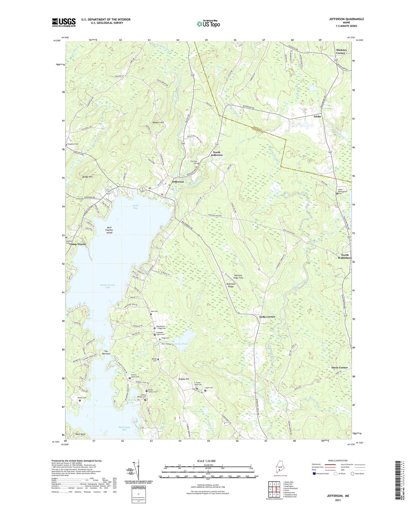
2024 topographic map quadrangle Jefferson in the state of Maine. Scale: 1:24000. Based on the newly updated USGS 7.5' US Topo map series, this map is in the following counties: Lincoln, Knox. The map contains contour data, water features, and other items you are used to seeing on USGS maps, but also has updated roads and other features. This is the next generation of topographic maps. Printed on high-quality waterproof paper with UV fade-resistant inks.
Quads adjacent to this one:
West: North Whitefield
Northwest: Weeks Mills
North: Razorville
Northeast: Washington
East: Union
Southeast: Waldoboro East
South: Waldoboro West
Southwest: Damariscotta
This map covers the same area as the classic USGS quad with code o44069b4.
Contains the following named places: Benner Brook, Bird Feather Island, Bodge Hill, Bogues Corner, Camp Kieve, Camp Wavus, Cooks Pond, Damariscotta Lake, Damariscotta Lake Farm, Damariscotta Lake State Park, Davis Stream, Eugley Hill, Fairview Cemetery, First Baptist Church, Flanders Corner, Forest Lake Cemetery, Globe, Great Bay, Haskell Hill, Jefferson, Jefferson Post Office, Jefferson Village School, Jefferson Volunteer Fire and Rescue Station 1, Jefferson Volunteer Fire and Rescue Storage, Kennedy Corner, Kieve Wavus Education School, Meadow Brook, Morang Cove, North Jefferson, North Waldoboro, Oliver - Burnheimer Cemetery, Orffs Corner, Pitcher Brook, Robinson Ridge, Robinson Ridge Field, Saint Giles Church, Shepherd Cemetery, Stickney Corner, The Narrows, Tobias Pond, West Branch Davis Stream, ZIP Code: 04348