MyTopo
Richardson Pond Maine US Topo Map
Couldn't load pickup availability
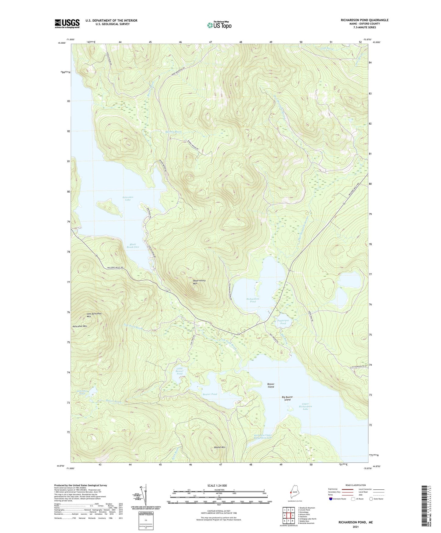
2024 topographic map quadrangle Richardson Pond in the state of Maine. Scale: 1:24000. Based on the newly updated USGS 7.5' US Topo map series, this map is in the following counties: Oxford. The map contains contour data, water features, and other items you are used to seeing on USGS maps, but also has updated roads and other features. This is the next generation of topographic maps. Printed on high-quality waterproof paper with UV fade-resistant inks.
Quads adjacent to this one:
Northwest: Bosebuck Mountain
North: Lincoln Pond
Northeast: Kennebago
East: Oquossoc
Southeast: Metallak Mountain
South: Middle Dam
Southwest: Umbagog Lake North
This map covers the same area as the classic USGS quad with code o44070h8.
Contains the following named places: Adamstown Township, Aziscohos Dam, Aziscohos Falls, Aziscohos Pond, Barney Brook, Beaver Brook, Beaver Island, Beaver Pond, Big Beaver Island, Black Brook Cove, Deer Mountain Stream, East Richardson Ponds, Fish Pond Brook, Little Beaver Pond, Low Aziscohos Mountain, Mill Brook, Observatory Mountain, Pepperpot Pond, Plantation of Lincoln, Richardson Pond, Round Mountain, Sunday Pond, Unorganized Territory of North Oxford, West Arm Upper Richardson Lake