MyTopo
Oquossoc Maine US Topo Map
Couldn't load pickup availability
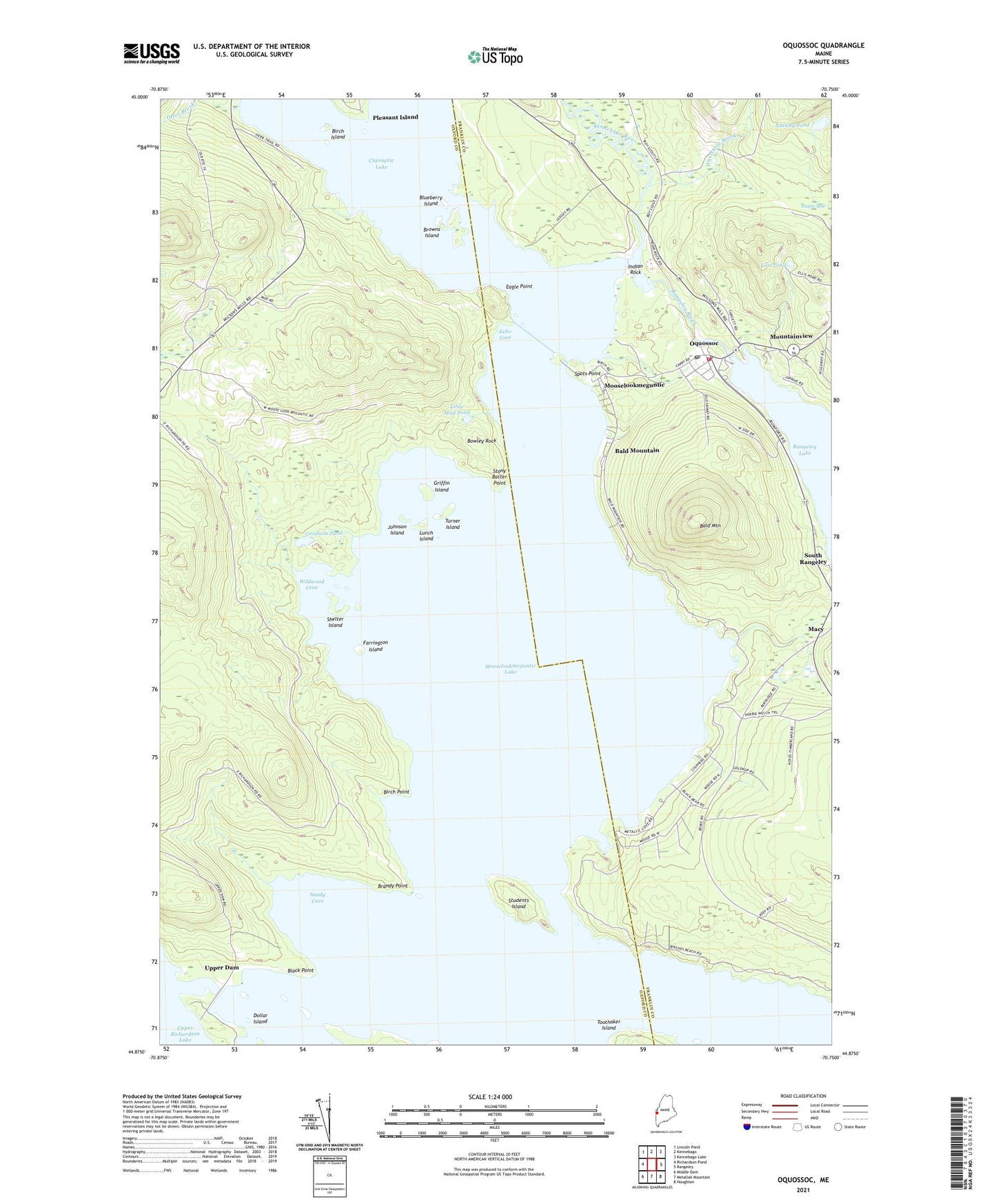
2024 topographic map quadrangle Oquossoc in the state of Maine. Scale: 1:24000. Based on the newly updated USGS 7.5' US Topo map series, this map is in the following counties: Oxford, Franklin. The map contains contour data, water features, and other items you are used to seeing on USGS maps, but also has updated roads and other features. This is the next generation of topographic maps. Printed on high-quality waterproof paper with UV fade-resistant inks.
Quads adjacent to this one:
West: Richardson Pond
Northwest: Lincoln Pond
North: Kennebago
Northeast: Kennebago Lake
East: Rangeley
Southeast: Houghton
South: Metallak Mountain
Southwest: Middle Dam
This map covers the same area as the classic USGS quad with code o44070h7.
Contains the following named places: Bald Mountain, Bald Mountain Camps, Birch Island, Birch Point, Black Point, Blueberry Island, Bowley Rock, Brandy Point, Browns Island, Clear Water Sporting Camps, Cupsuptic Lake, Dollar Island, Eagle Point, Echo Cove, Ellis Pond, Farrington Island, Goodwin Pond, Griffin Island, Haines Landing Marina, Hayno Bog, Indian Rock, Johnson Island, Kennebago River, Little Mud Pond, Lunch Island, Macy, Milrose Trail, Mooselookmeguntic, Mooselookmeguntic Lake, Mountain View Camps, Mountainview, Nutting Pond, Oquossoc, Oquossoc Angling Association, Oquossoc Log Church, Oquossoc Post Office, Otter Brook, Our Lady of the Lakes Catholic Church, Pleasant Island, Rangeley Lake Dam, Rangeley River, Rangeley Volunteer Fire Department Company 2, Sandy Cove, Shelter Island, South Rangeley, Spots Point, Stephen Phillips Preserve, Stony Batter Point, Students Island, Turner Island, Upper Dam, Whetstone Brook, Wildwood Cove, Wildwood Cove Church