MyTopo
Saint Agatha Maine US Topo Map
Couldn't load pickup availability
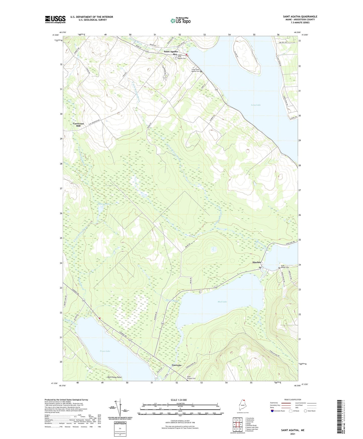
2024 topographic map quadrangle Saint Agatha in the state of Maine. Scale: 1:24000. Based on the newly updated USGS 7.5' US Topo map series, this map is in the following counties: Aroostook. The map contains contour data, water features, and other items you are used to seeing on USGS maps, but also has updated roads and other features. This is the next generation of topographic maps. Printed on high-quality waterproof paper with UV fade-resistant inks.
Quads adjacent to this one:
West: Daigle
Northwest: Frenchville
North: Madawaska
Northeast: Grand Isle
East: Paulette Brook
Southeast: Stockholm
South: Square Lake East
Southwest: Square Lake West
This map covers the same area as the classic USGS quad with code o47068b3.
Contains the following named places: Carriveau Mill, Cross Lake Seaplane Base, Cross Lake Township, Daigle Brook, Dickey Brook, Dickey Pond, East Fork Dickey Brook, Factory Brook, Guerette, Harris Brook, Long Lake Public Library, Lower Saint Agatha Cemetery, Matrimony Point, McLean Brook, Mud Lake, North Fork McLean Brook, North Lake Fire Rescue Cross Lake Substation, Patrick Therriault School, Red Arrow Snowmobile Club, Saint Agatha, Saint Agatha Cemetery, Saint Agatha Church, Saint Agatha Post Office, Saint Agatha Volunteer Fire Department, Saint Etropus Cemetery, Saint Joseph Cemetery, Saint Josephs Church, Sinclair, Sinclair Post Office, Town of Saint Agatha, Upper Saint Agatha Cemetery, West Fork Dickey Brook, West Fork McLean Brook, Wisdom Middle / High School, ZIP Code: 04772