MyTopo
Square Lake East Maine US Topo Map
Couldn't load pickup availability
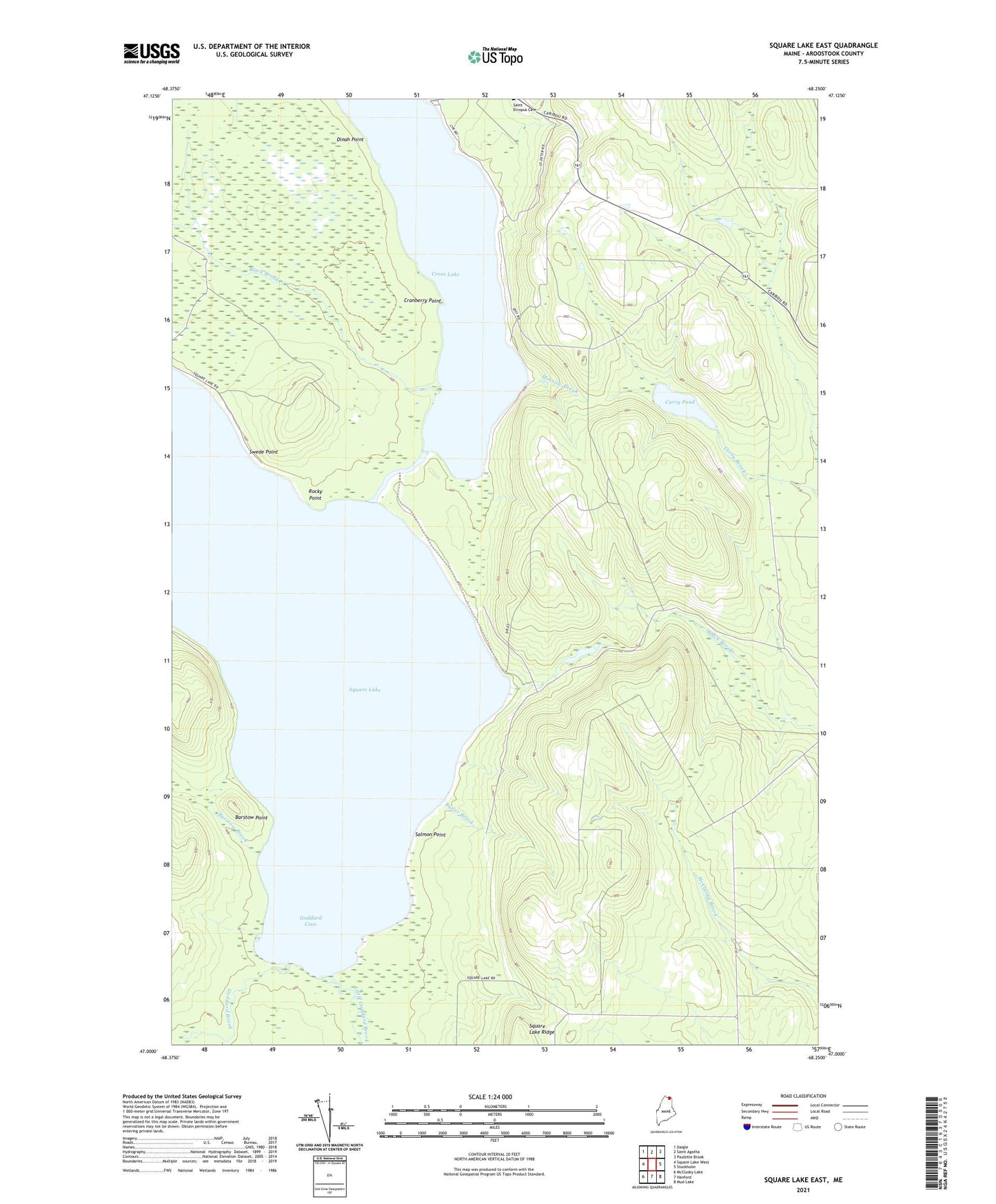
2024 topographic map quadrangle Square Lake East in the state of Maine. Scale: 1:24000. Based on the newly updated USGS 7.5' US Topo map series, this map is in the following counties: Aroostook. The map contains contour data, water features, and other items you are used to seeing on USGS maps, but also has updated roads and other features. This is the next generation of topographic maps. Printed on high-quality waterproof paper with UV fade-resistant inks.
Quads adjacent to this one:
West: Square Lake West
Northwest: Daigle
North: Saint Agatha
Northeast: Paulette Brook
East: Stockholm
Southeast: Mud Lake
South: Hanford
Southwest: McClusky Lake
This map covers the same area as the classic USGS quad with code o47068a3.
Contains the following named places: Austin Camp, Barstow Brook, Barstow Point, Black Brook, Burnt Landing, Butler Brook, Carry Pond, Cranberry Point, Cross Lake, Dinah Point, Fraser Camp, Goddard Brook, Goddard Cove, Gorfinkle Camp, Little Goddard Brook, Minnow Brook, Rocky Point, Salmon Point, Square Lake, Swede Point, T16 R5 WELS, The Carry, Unorganized Territory of Square Lake, ZIP Code: 04779