MyTopo
Sanford Maine US Topo Map
Couldn't load pickup availability
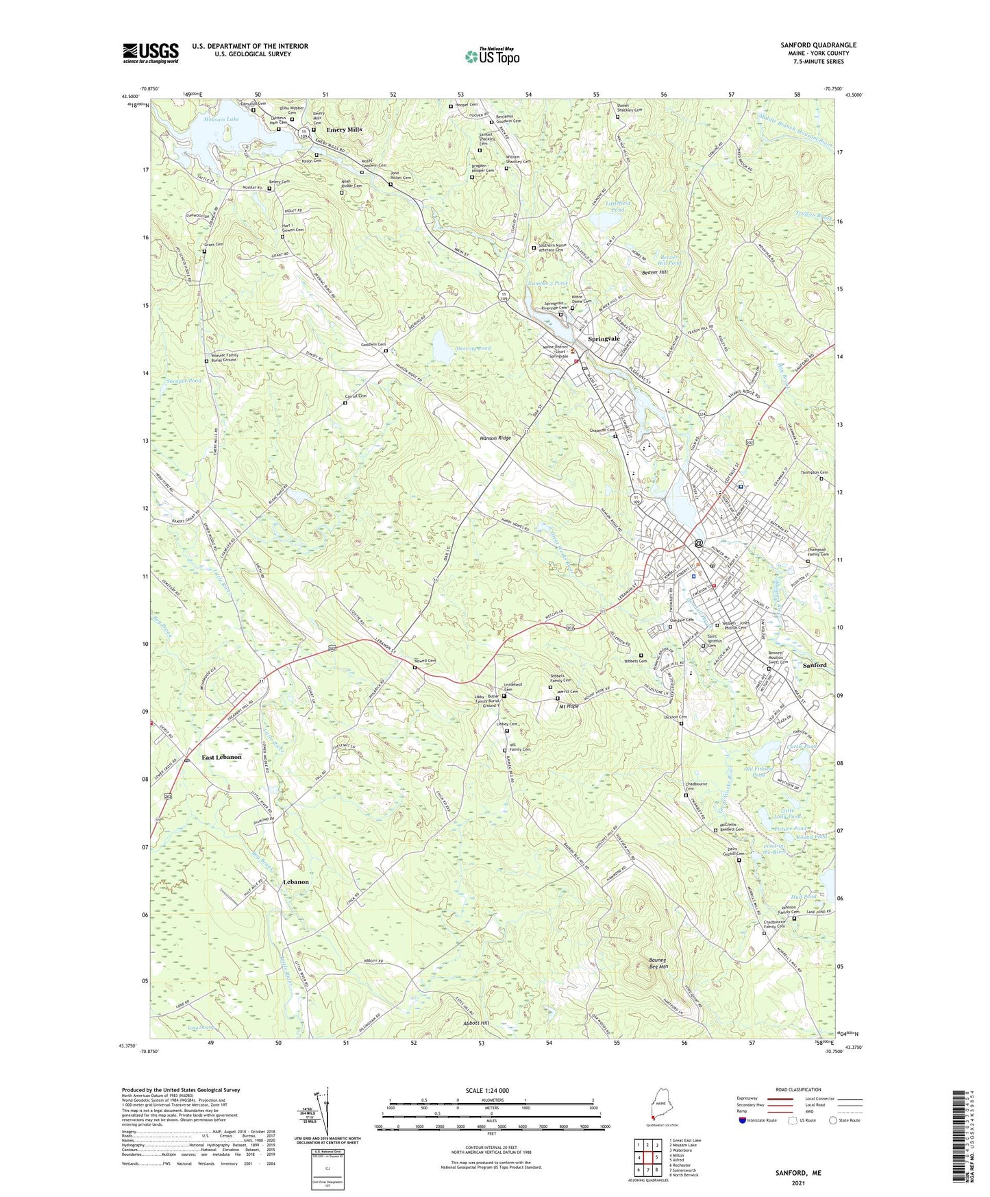
2024 topographic map quadrangle Sanford in the state of Maine. Scale: 1:24000. Based on the newly updated USGS 7.5' US Topo map series, this map is in the following counties: York. The map contains contour data, water features, and other items you are used to seeing on USGS maps, but also has updated roads and other features. This is the next generation of topographic maps. Printed on high-quality waterproof paper with UV fade-resistant inks.
Quads adjacent to this one:
West: Milton
Northwest: Great East Lake
North: Mousam Lake
Northeast: Waterboro
East: Alfred
Southeast: North Berwick
South: Somersworth
Southwest: Rochester
This map covers the same area as the classic USGS quad with code o43070d7.
Contains the following named places: Bauneg Beg Mountain, Beaver Hill, Beaver Hill Pond, Benjamin Goodwin Cemetery, Bennett Moulton Sweat Cemetery, Bennett Moulton Swett Cemetery, Benton Playground, Bog Brook, Bragdon - Hooper Cemetery, Carl Lamb School, Carpentier Park, Carroll Cemetery, Central School, Chadbourne Cemetery, Chapman Cemetery, City of Sanford, Colonial Village Shopping Center, Curtis Pond, Daniel Shackley Cemetery, Davis - Guptill Cemetery, Deering Pond, Dickson Cemetery, Downtown Center Park, East Lebanon, Edison School, Edmunds Cemetery, Elihu Webber Cemetery, Emerson School, Emery Cemetery, Emery Mills, Emery Mills Cemetery, Emery Mills Dam, Emmanuel Christian Fellowship Building, First Baptist Church, First Church of Christ Scientist, Goodall Brook, Goodall Hospital Heliport, Goodall Park, Goodall-Sanford Dam, Goodwin Cemetery, Gowen Park, Hanson Ridge, Harris School of Business, Hart / Gowen Cemetery, Heath Brook, Hill Family Cemetery, Hooper Cemetery, John Ricker Cemetery, Johnson Family Cemetery, Lafayette School, Lebanon, Lebanon Fire and Rescue Department Station 1, Lebanon Post Office, Lebbeus Ham Cemetery, Libbey Cemetery, Libby - Butler Family Burial Ground 1, Lincoln School, Little Long Pond, Littlefield Cemetery, Littlefield Pond, Louis B Goodall Memorial Library, Margaret Chase Smith Elementary School, Merrill Cemetery, Mid-Town Mall Shopping Center, Mill Street Dam, Moses Goodwin Cemetery, Mount Hope, Mud Pond, Nason Cemetery, Nasson College, Noah Ricker Cemetery, North Parish Congregational Church, Notre Dame Cemetery, Notre Dame Church, Notre Dame School, Nowell Cemetery, Number 3 Pond, Number One Pond, Oakdale Cemetery, Old Fishing Pond, Picture Pond, Pond-in-the-River, River Street Dam, Roosevelt School, Round Pond, Sacapee Pond, Saint Georges Church, Saint Ignatius Cemetery, Saint Ignatius Church, Saint Thomas School, Samuel Shackley Cemetery, Sand Pond, Sandford Post Office, Sanford, Sanford Census Designated Place, Sanford Fire Department Central Station, Sanford Fire Department Roseville Training Facility, Sanford Fire Department Springvale Station, Sanford High School, Sanford Middle School, Sanford Police Department, Sanford Regional Technical Center, Sanford Town Hall, Sanford-Springvale Chamber of Commerce, Southern Maine Health Care Sanford Medical Center, Southern Maine Veterans Cemetery, Springvale, Springvale Census Designated Place, Springvale Park, Springvale Post Office, Springvale Public Library, Springvale Riverside Cemetery, Springvale School, Stump Pond, Tebbets - Jones - Phillips Cemetery, Tebbets Cemetery, Thompson Cemetery, Thompson Family Cemetery, Unitarian Church, University of Southern Maine - Sanford, Willard School, William Shackley Cemetery, WMEA-TV (Biddeford), Worster Family Burial Ground, WPHX-AM (Sanford), WPHX-FM (Sanford), ZIP Code: 04083