MyTopo
Snow Mountain Maine US Topo Map
Couldn't load pickup availability
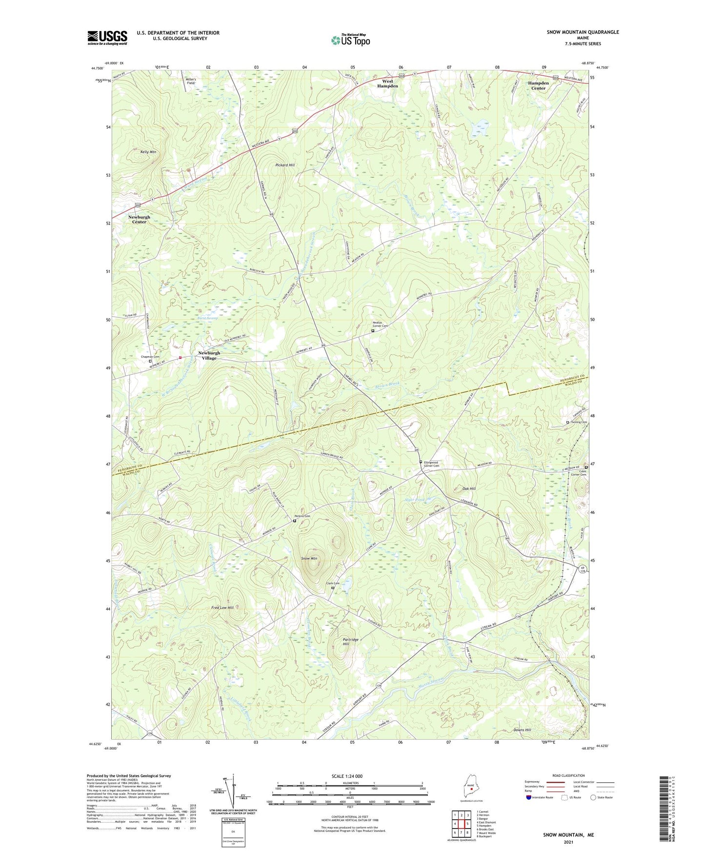
2021 topographic map quadrangle Snow Mountain in the state of Maine. Scale: 1:24000. Based on the newly updated USGS 7.5' US Topo map series, this map is in the following counties: Penobscot, Waldo. The map contains contour data, water features, and other items you are used to seeing on USGS maps, but also has updated roads and other features. This is the next generation of topographic maps. Printed on high-quality waterproof paper with UV fade-resistant inks.
Quads adjacent to this one:
West: East Dixmont
Northwest: Carmel
North: Hermon
Northeast: Bangor
East: Hampden
Southeast: Bucksport
South: Mount Waldo
Southwest: Brooks East
Contains the following named places: Alger Pond, Brown Brook, Burnt Swamp, Chapman Cemetery, Clark Brook, Clark Cemetery, Clements Brook, Ellingwood Corner, Ellingwood Corner Cemetery, Fred Low Hill, Hampden Center, Hampden Country Club, Kelly Mountain, Longfellow School, Nealeys Corner, Neallys Corner Cemetery, Neallys Corner Methodist Church, Newburgh Community Library, Newburgh Elementary School, Newburgh Village, Newburgh Volunteer Fire Station, Oak Hill, Partridge Hill, Perkins Cemetery, Pickard Hill, Snow Mountain, Town of Hampden, Town of Winterport, Twining Cemetery, West Hampden, West Hampden Baptist Church, Whites Corner, Winterport Station, ZIP Codes: 04444, 04496