MyTopo
South Lagrange Maine US Topo Map
Couldn't load pickup availability
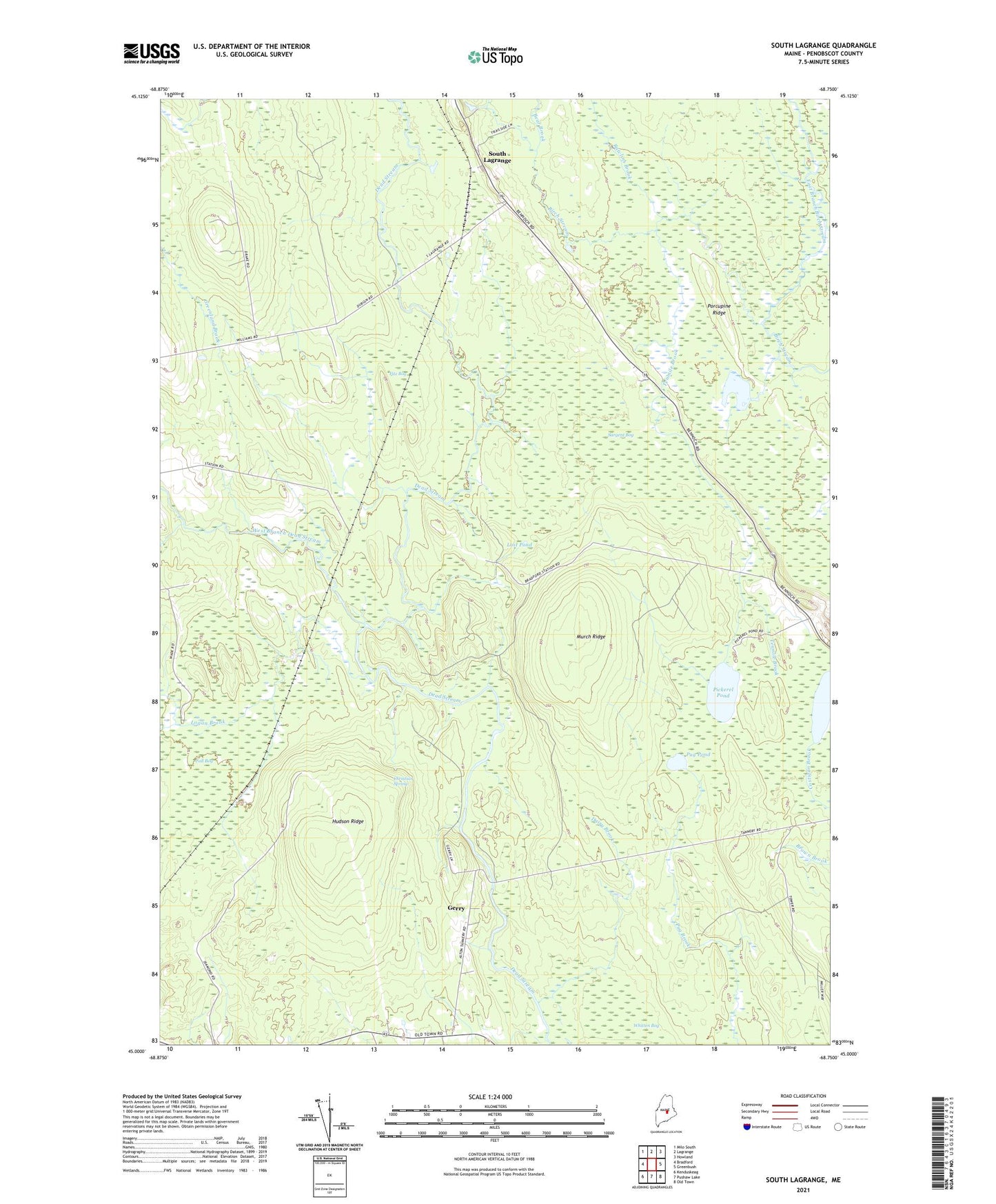
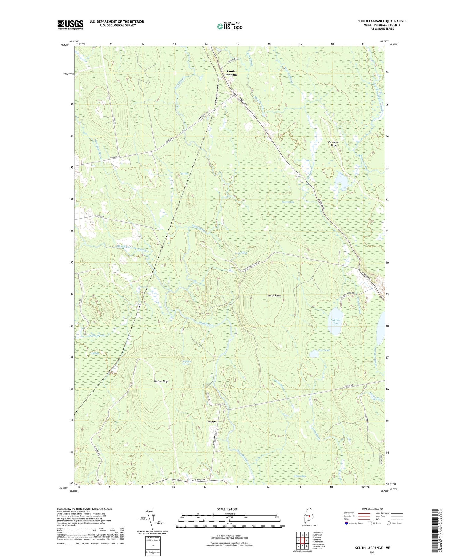
2021 topographic map quadrangle South Lagrange in the state of Maine. Scale: 1:24000. Based on the newly updated USGS 7.5' US Topo map series, this map is in the following counties: Penobscot. The map contains contour data, water features, and other items you are used to seeing on USGS maps, but also has updated roads and other features. This is the next generation of topographic maps. Printed on high-quality waterproof paper with UV fade-resistant inks.
Quads adjacent to this one:
West: Bradford
Northwest: Milo South
North: Lagrange
Northeast: Howland
East: Greenbush
Southeast: Old Town
South: Pushaw Lake
Southwest: Kenduskeag
Contains the following named places: Bear Brook, Bradford Station, Call Bog, Christian Spring, Dairy Brook, East Branch Birch Stream, Fitz Bog, Gerry, Greenland Brook, Holland Pond, Hudson Ridge, Logan Brook, Lost Pond, Murch Ridge, Pickerel Pond, Porcupine Ridge, Pug Pond, Rawlins Brook, Ricker Siding, Sargent Bog, South Lagrange, Tenmile Brook, Town of Alton, West Branch Dead Stream, Whitten Bog