MyTopo
Howland Maine US Topo Map
Couldn't load pickup availability
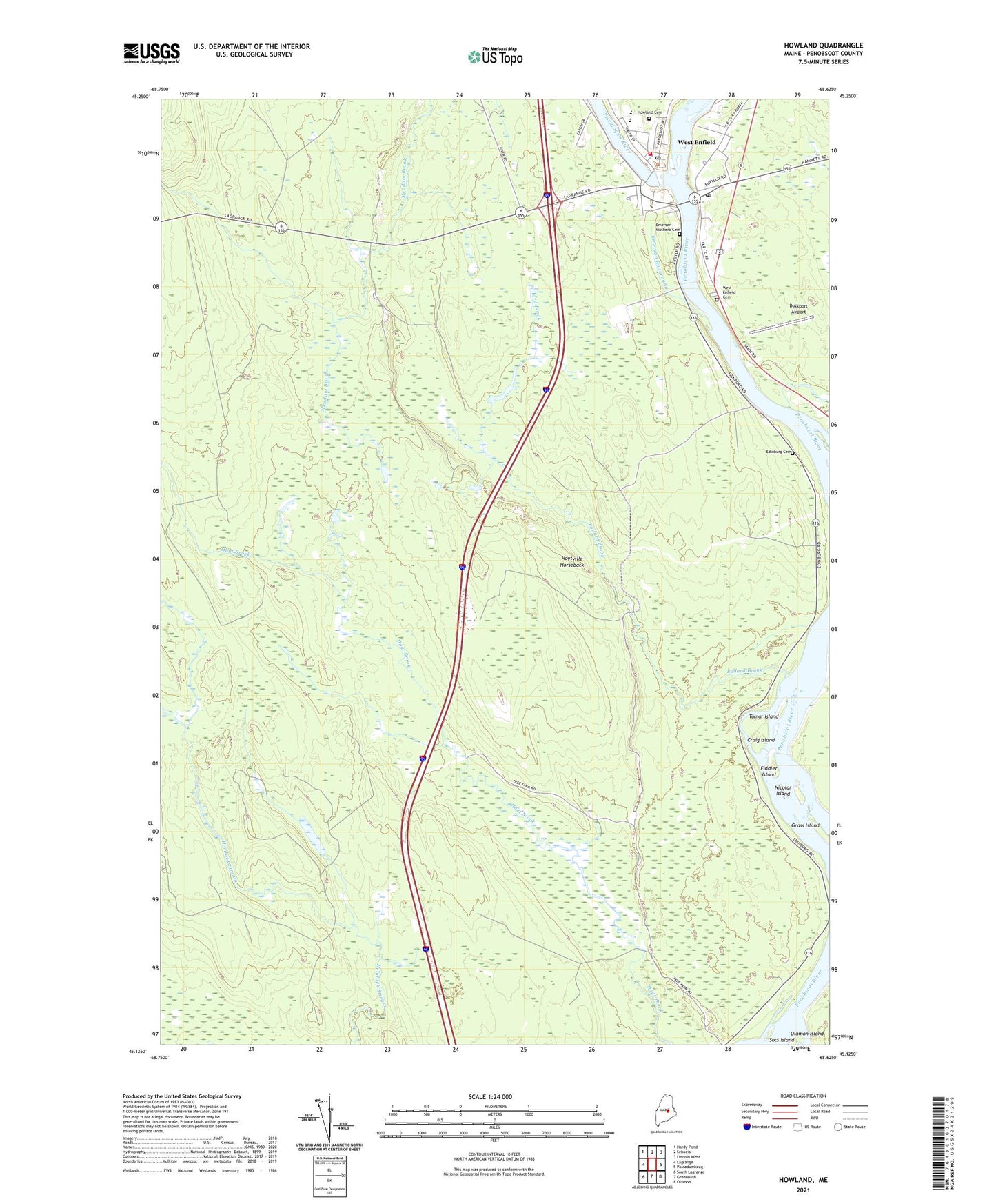
2024 topographic map quadrangle Howland in the state of Maine. Scale: 1:24000. Based on the newly updated USGS 7.5' US Topo map series, this map is in the following counties: Penobscot. The map contains contour data, water features, and other items you are used to seeing on USGS maps, but also has updated roads and other features. This is the next generation of topographic maps. Printed on high-quality waterproof paper with UV fade-resistant inks.
Quads adjacent to this one:
West: Lagrange
Northwest: Hardy Pond
North: Seboeis
Northeast: Lincoln West
East: Passadumkeag
Southeast: Olamon
South: Greenbush
Southwest: South Lagrange
This map covers the same area as the classic USGS quad with code o45068b6.
Contains the following named places: Buzzport Airport, Church of God, Craig Island, Edinburg Cemetery, Emerson Runaround, Fiddler Island, Grass Island, Hichborn Middle School, Howland, Howland Baptist Church, Howland Dam, Howland Fire Department, Howland Post Office, Howland United Methodist Church, Hoytville Horseback, Nicolar Island, Olamon Island, Penobscot Valley High School, Piscataquis River, Piscataquis River Reservoir, Pollard Brook, Saint Leos Church, Thomas Free Library, Tomar Island, Town of Edinburg, West Enfield, West Enfield Cemetery, West Enfield Post Office