MyTopo
South Sebec Maine US Topo Map
Couldn't load pickup availability
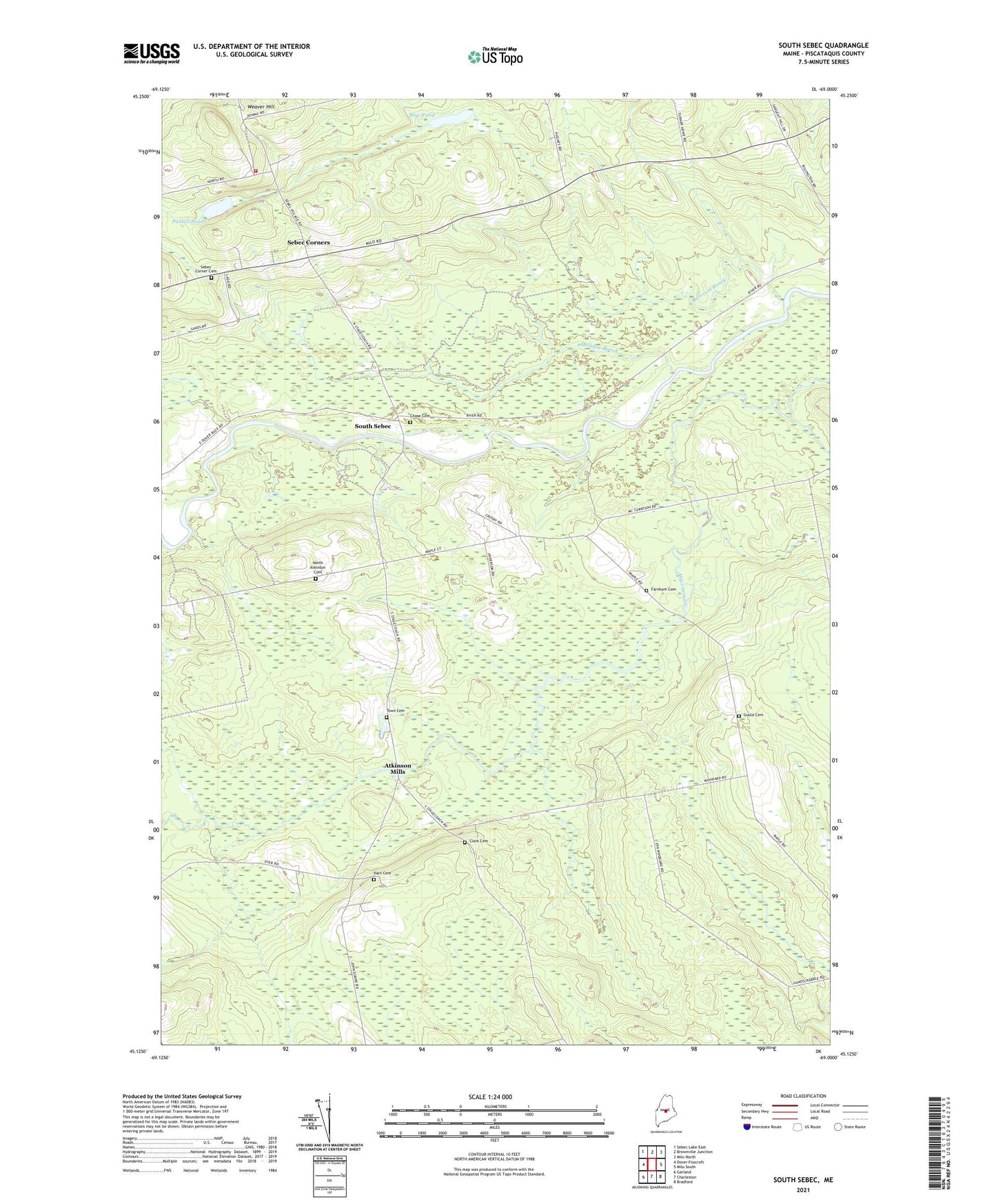
2021 topographic map quadrangle South Sebec in the state of Maine. Scale: 1:24000. Based on the newly updated USGS 7.5' US Topo map series, this map is in the following counties: Piscataquis. The map contains contour data, water features, and other items you are used to seeing on USGS maps, but also has updated roads and other features. This is the next generation of topographic maps. Printed on high-quality waterproof paper with UV fade-resistant inks.
Quads adjacent to this one:
West: Dover-Foxcroft
Northwest: Sebec Lake East
North: Brownville Junction
Northeast: Milo North
East: Milo South
Southeast: Bradford
South: Charleston
Southwest: Garland
Contains the following named places: Atkinson Church, Atkinson Corners, Atkinson Mills, Atkinson School, Chase Cemetery, Clark Cemetery, Dow Pond, Farnham Cemetery, Gould Cemetery, Gulf Stream, Hall Brook, Hart Cemetery, Kingdom Hall, Ladd School, Maple School, Meadow Brook, Morrison Brook, Morrison School, North Atkinson Cemetery, Parker Pond, Sebec Corner Cemetery, Sebec Corners, Sebec Station, Sebec Volunteer Fire Department North Road Station, South Sebec, Town Cemetery, Town of Atkinson, Town of Sebec, ZIP Code: 04481